- The Mestia to Ushguli trek is a 4-day walk of roughly 55 to 58 km through Upper Svaneti, with about 3,000 m of total ascent and a family guesthouse at the end of every stage.
- Day 3, about 18 km from Adishi over the Chkhutnieri Pass (roughly 2,700 m), is the hardest, and it starts with a ford of the glacier-fed Adishchala River that you can cross on a hired horse.
- Walk between July and mid-September: in June snow often lies on the pass and the rivers run high, and most guesthouses close by early October.
- Fit hikers manage it without a guide using an offline map, but bring cash, start early each day and be ready to wait out bad weather.
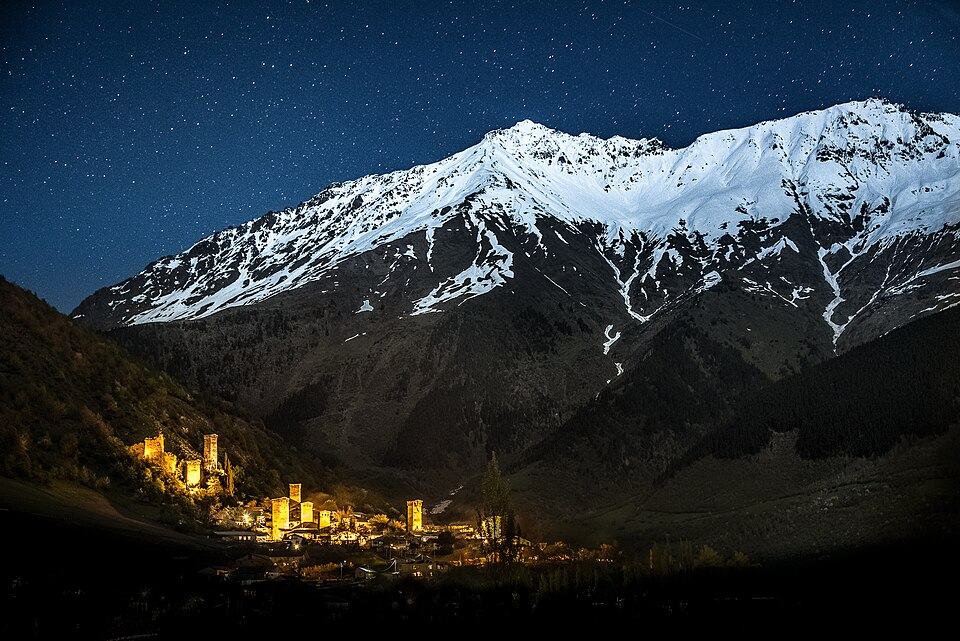
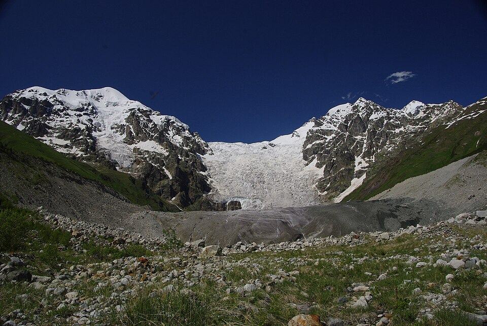
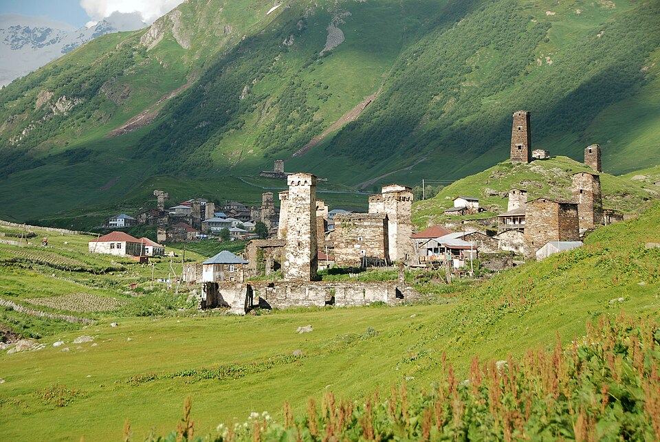
The Mestia to Ushguli trek is Georgia's best-known multi-day hike: four days on foot between the two main settlements of Upper Svaneti, covering about 55 to 58 km and climbing roughly 3,000 m in total. You cross two high ridges and one pass close to 2,700 m, walk beneath the icefall of the Adishi Glacier and pass through villages of medieval stone towers. Every night you sleep in a family guesthouse, so a daypack is all you need to carry.
It is a moderate trek rather than a hard one, but it is a real mountain route, with a river to ford, one long day and weather that turns quickly. This guide breaks down each stage with distances, climbs and timings, explains how to reach Mestia and get back from Ushguli, and covers guesthouses, luggage transfer, the best months, what to pack and how to navigate. It ends with side trips and advice on whether to hire a guide.
Mestia to Ushguli trek at a glance
The classic route has four stages. Published figures differ by a kilometre or two and a hundred metres of climbing, depending on the variant you follow and where exactly you sleep, so treat these as typical values.
| Day | Stage | Distance | Ascent / descent | Walking time | Overnight |
|---|---|---|---|---|---|
| 1 | Mestia to Zhabeshi | 15 to 16 km | +750 to 800 m / -500 m | 5 to 6 h | Zhabeshi or Chvabiani |
| 2 | Zhabeshi to Adishi | about 11 km | +900 m / -500 to 550 m | 5 to 6 h | Adishi |
| 3 | Adishi to Iprali via the Chkhutnieri Pass | 17 to 19 km | +850 m / -1,050 m | 7 to 9 h | Iprali or Lalkhori (Khalde for a shorter day) |
| 4 | Iprali to Ushguli | 12 to 13 km | +500 to 700 m / -250 to 450 m | 4 to 5 h | Ushguli |
| Total | Mestia to Ushguli | about 55 to 58 km | about +3,100 m / -2,400 m | 21 to 25 h | 3 nights on the trail, then Ushguli |
Day 3 is the crux, because the longest stage, the river crossing and the pass all fall on the same day. Days 1 and 2 are moderate but include long climbs, and day 4 is the gentlest. Most people walk west to east: Ushguli makes the better finale, and the horsemen who carry walkers across the river work from the Adishi side. You can walk it in reverse, but arrange your crossing in advance.
How to get to Mestia: the road from Zugdidi and flights
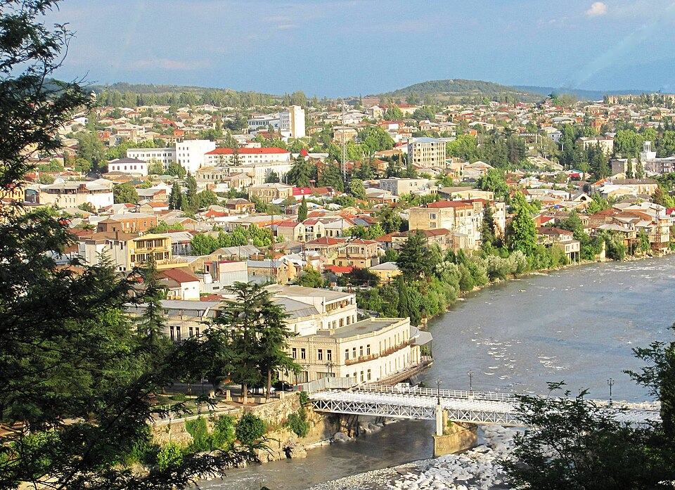
Mestia lies in the far north-west of Georgia, about 450 km from Tbilisi by road. Nearly everyone comes through Zugdidi, the lowland capital of Samegrelo, from where a paved road of about 130 km climbs the Enguri gorge past the Enguri reservoir and the village of Khaishi. By car the drive from Zugdidi takes about 3 hours.
- Train and minibus: ride the train from Tbilisi to Zugdidi, about 5.5 hours, then a marshrutka up to Mestia, 3.5 to 4 hours. In summer the minibuses gather near Zugdidi railway station to meet passengers.
- Direct marshrutka from Tbilisi: 8 to 9 hours, simple but very long.
- From Kutaisi: Kutaisi International Airport has many budget flights from Europe and is about 1.5 hours from Zugdidi, so you can land and reach Mestia the same day by driver or minibus.
- Private transfer: a driver from Kutaisi or Zugdidi lets you stop at the Enguri Dam and the tower villages along the upper valley.
Small planes also fly to Mestia's Queen Tamar Airport from Natakhtari airfield, north of Tbilisi near Mtskheta, in about an hour, and there have been services from Kutaisi. Seats are few and flights are cancelled whenever mountain weather is poor, which is often. Book early, keep a road option in reserve, and do not rely on a flight on the day you need to make an international connection.
Day 1: Mestia to Zhabeshi
The first day sets the tone: a long climb out of Mestia, a high traverse with the best mountain panorama of the trek, and a descent into the Mulkhura valley. From town the route crosses the ridge to the east on farm tracks and paths, climbing steadily through meadows and patches of forest. Waymarking is patchy on this stage, so have the route open on your phone from the very start.
On a clear day you see Ushba's double summit behind you and the white pyramid of Tetnuldi (4,858 m) ahead, with the main Caucasus ridge along the horizon. After the traverse the path drops through forest to Zhabeshi, a small village on the Mulkhura River, or neighbouring Chvabiani, which is slightly closer to the start of day 2. Both have family guesthouses. In poor visibility, some walkers skip the ridge and follow the valley road instead: it is longer and dustier, but impossible to lose.
Day 2: Zhabeshi to Adishi
Day 2 is the shortest stage but has the biggest single climb. From Zhabeshi you cross the river and gain about 900 m through forest and open grassland onto the ridge between the Mulkhura and Adishi valleys, passing below the lifts of the Tetnuldi ski resort. The gradient is steady rather than technical, with good places to rest and look back toward Mestia.
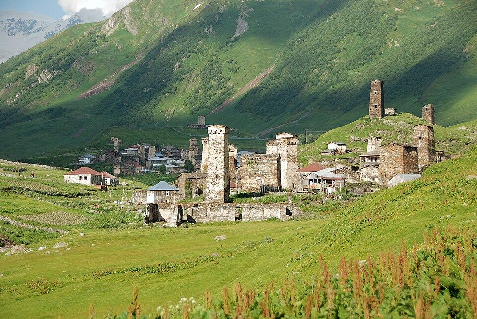
From the top, at roughly 2,500 to 2,700 m depending on your line, Tetnuldi rises directly in front of you. The descent to Adishi, at about 2,040 m, is steep in places and hard on the knees, so poles help. Adishi is a tiny village without a proper road, with a few dozen permanent residents, stone towers, small medieval churches and several guesthouses that fill quickly in August. It gave its name to the Adishi Gospels of 897, one of the oldest dated Georgian Gospel books.
Day 3: Adishi to Iprali, the river crossing and the Chkhutnieri Pass
This is the big day. From Adishi the path follows the Adishchala River upstream along the valley floor, with the icefall of the Adishi Glacier growing ahead of you, until you reach the ford. On the far bank the climb begins almost at once: steep zigzags up grassy slopes to the Chkhutnieri Pass, also spelled Chkhunderi, which at roughly 2,700 m is the highest ground on the route. The views back to the glacier pouring off the main ridge are among the finest of the route.
Crossing the Adishchala River
There is no permanent bridge at the usual crossing. In peak season local horsemen wait at the river from around 9 am and carry walkers over for a cash fee; outside July and August, ask your Adishi guesthouse to arrange a horse the evening before. The water is glacier melt, so it is lowest early in the morning and rises through the day as the sun works on the ice. In late summer it may be knee-deep, but after rain or on a hot afternoon it can be fast, cold and dangerous.
- Leave Adishi early so you reach the river while the water is low.
- If you wade, pick the widest, slowest section, unclip your hip belt, use poles and face upstream.
- Water shoes or sandals and a small towel save your boots and feet.
- If the current looks too strong and no horse is available, wait or turn back.
Beyond the pass the trail descends long meadows into the Khaldechala valley to Khalde, a hamlet of ruined towers. Khalde rose against Russian imperial rule in 1875 to 1876 and was destroyed in reprisal; some families have since returned, and a few offer rooms, which is useful if you want to break the day. From Khalde a farm track follows the river down to Iprali and Lalkhori, where most trekkers spend the third night.
Day 4: Iprali to Ushguli
The final stage is the easiest. The Mestia to Ushguli road runs along this part of the valley and you follow it for some of the day, but the nicer line takes a forest path on the hillside through the village of Davberi, high above the river, before rejoining the road for the last approach. Expect a gradual climb of 500 to 700 m over 4 to 5 hours.
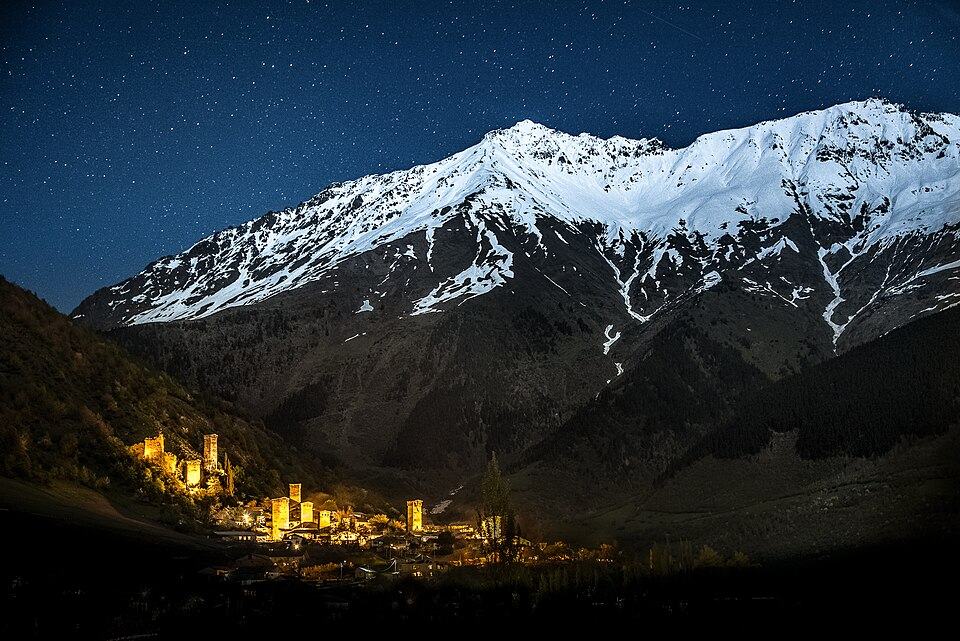
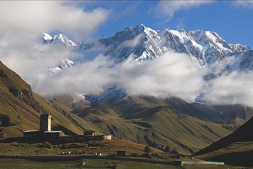
Murkmeli is the first of Ushguli's hamlets, followed by Chazhashi, the UNESCO-protected core crowded with towers, and Zhibiani below Lamaria Church. With Shkhara, Georgia's highest mountain at about 5,200 m, closing off the valley, it is a fitting finish. Stay at least one night to see the towers in evening and early light. Shared 4x4s and taxis return to Mestia in about 1.5 hours on the paved road.
Guesthouses, food and luggage transfer on the trek
Every overnight stop has family guesthouses, from rooms in old stone houses to newer wooden lodges. Most offer half board, a hot dinner and breakfast, with a packed lunch on request. Rooms are simple, often with shared bathrooms, and hot water can be erratic in Adishi. In July and August book at least Adishi and the third night ahead, by phone, messaging app or booking site.
Dinners are generous Svan home cooking: kubdari, bread stuffed with spiced meat; tashmijabi, mashed potato beaten with sulguni until it stretches; soups, tomato and cucumber salads sprinkled with Svanetian salt, and plenty of bread and cheese. Vegetarians are catered for if they say so in advance. A few seasonal drink stands appear along the trail in high summer, but carry lunch and snacks every day. Pay in cash: there is no reliable ATM after Mestia.
Luggage transfer
Most Mestia guesthouses will store your main bag free while you walk, and you can collect it on the way back from Ushguli. Alternatively, guesthouses and drivers can send bags by car to Ushguli, and between some villages on the way. Adishi is the awkward stop: moving a bag there depends on a horse or on whether a 4x4 can get through, so keep everything you need for that night in your daypack. Agree arrangements and prices before you set off.
Best time to hike Mestia to Ushguli, and snow on the pass
The main season runs from July to mid-September. By July the snow on the Chkhutnieri Pass has usually gone, the guesthouses are open and the rivers have dropped from their early-summer peak, although glacier melt still swells the Adishchala on hot afternoons. September is often the most settled month, with clear views, cool air and autumn colour by its end.
| Month | Trail conditions | Guesthouses |
|---|---|---|
| June | Steep, icy snow possible on the north-facing climb to the pass; high, cold rivers | Opening during the month |
| July | Pass usually clear; flowers in the meadows; afternoon storms | Open, busy from mid-month |
| August | Most stable conditions, busiest trail | Open; book ahead |
| September | Settled weather, cold nights, lower rivers | Open, closing from late month |
| October | Fresh snow on the pass possible, short days | Mostly closed |
In June, and in some years into early July, go only with experience on snow, poles and local advice or a guide. Outside the summer season the route becomes a winter mountaineering undertaking rather than a village walk.
Variations and side trips: Koruldi, Chalaadi, Mazeri and Shkhara
Many hikers add a day or two at either end. Around Mestia, the best warm-up is the Koruldi Lakes, small tarns at about 2,740 m that reflect Ushba, reached by a long, steep day on foot or a shorter one if a 4x4 takes you up. The Chalaadi Glacier is an easy half day from a bridge about 10 km north of town, ideal when cloud covers the high routes. For a quieter extra night, Mazeri in the Becho valley, about 25 km west of Mestia, has a walk to the Shdugra Waterfall below Ushba.
At the far end, the classic extra is the day hike from Ushguli up the open upper Enguri valley to the Shkhara Glacier, about 16 km return and 6 hours, mostly gentle. You can also stop at Khalde on day 3 and walk a longer day 4. Leaving Svaneti, a summer road from Ushguli over the Zagari Pass to Lentekhi and Kutaisi makes a scenic exit; it is rough in places and usually open until around mid-October.
Mestia to Ushguli with a guide or on your own?
Independent hiking is normal here. In July and August, fit walkers with some mountain experience do the trek alone or in pairs every day, booking guesthouses as they go. The trail is not technical, and you are never more than a few hours from a village.
A guide is worth it if you are new to multi-day hiking, walking in June or late September, or would rather hand over the logistics. A local guide reads the river and the weather, deals with horses and hosts, explains the towers and Svan customs, and arranges luggage so you carry only a daypack. Our Svaneti trek does all of this and adds an acclimatisation day at the Koruldi Lakes. If you would rather see Mestia and Ushguli by car within a longer trip, look at the Grand Tour with Svaneti.
Mestia to Ushguli trek FAQ
How long is the Mestia to Ushguli trek?
About 55 to 58 km over four days, with roughly 3,000 m of ascent. Stages range from about 11 to 19 km, and walking time is usually 4 to 9 hours a day.
How hard is the Mestia to Ushguli trek?
It is moderate. You need the fitness for climbs of 750 to 900 m a day and one stage of 7 to 9 hours, but no technical skills. The tricky parts are the Adishchala crossing and the pass in bad weather.
Can you do the Mestia to Ushguli trek without a guide?
Yes. Most walkers in July and August go independently with an offline map and guesthouse bookings. Consider a guide in June or late September, or if you have little hiking experience.
Is there a bridge over the river near Adishi?
Not at the usual crossing point on day 3. You wade the Adishchala or pay a local horseman to take you across, and the water is lowest early in the morning.
Is it possible to walk from Mestia to Ushguli in 3 days?
Yes. The usual shortcut is a taxi ride to Zhabeshi, skipping day 1, so your first day is the climb to Adishi. Very fit walkers sometimes join days 3 and 4 instead, but that means a long, tiring push and a late arrival in Ushguli.
Do I need a tent or my own food?
No tent is needed, because every stage ends at guesthouses serving dinner and breakfast. Carry a packed lunch, snacks and water each day, as there are few places to buy food on the trail.
How do you get back from Ushguli to Mestia?
Shared 4x4s and taxis cover the paved road in about 1.5 hours; ask your Ushguli guesthouse to book a seat the evening before. In summer you can also leave over the Zagari Pass toward Lentekhi and Kutaisi.
Can I send my luggage from Mestia to Ushguli?
Yes. Guesthouses and drivers in Mestia can send bags to Ushguli by car or store them free while you walk. Moving bags to Adishi is harder, because it has no proper road.