St Andrew Trail, Borjomi-Kharagauli National Park
Borjomi-Kharagauli's longest marked trek: 54 km over four days from Atskuri to Marelisi, over Sametskhvario (2,642 m), the park's highest summit, sleeping in staffed tourist shelters. About 2,350 m up and 2,800 m down.
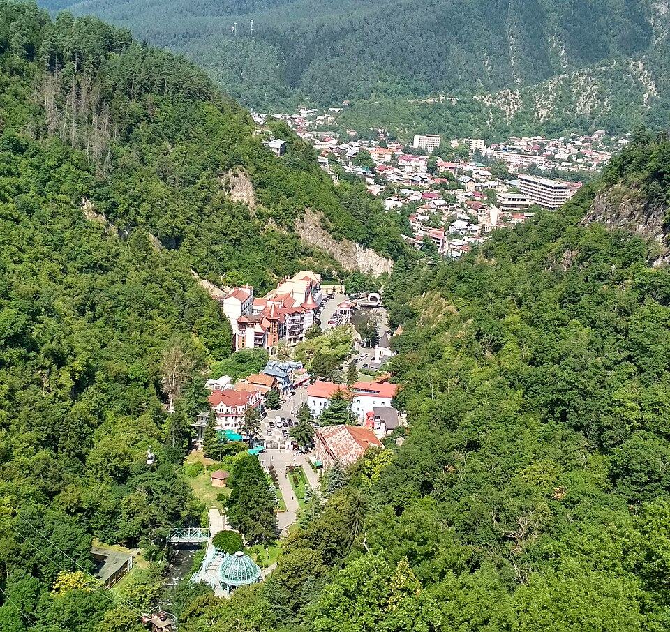
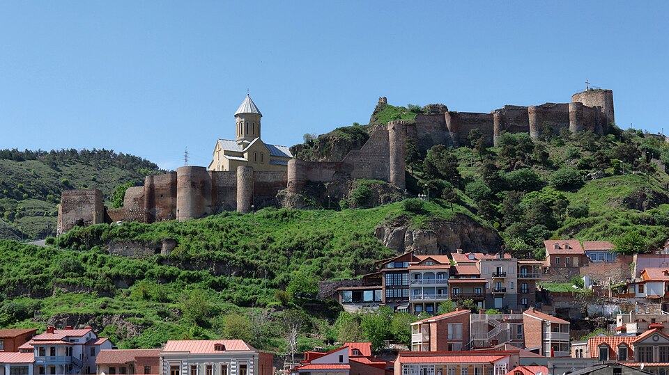
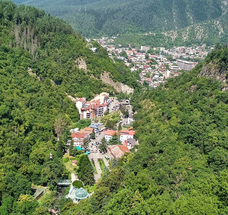 Borjomi Central Park & Mineral SpringsPhoto: Sergey Sebelev, CC BY-SA 4.0
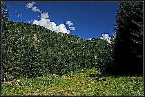
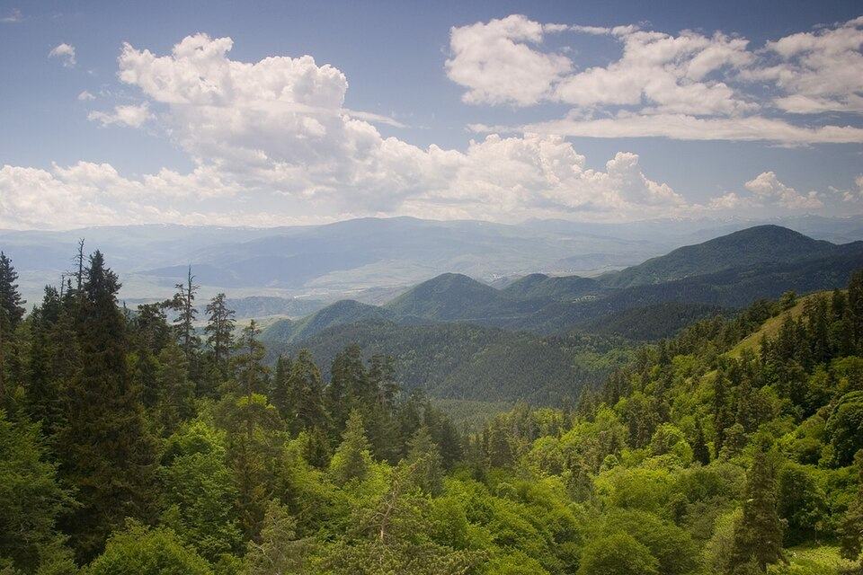
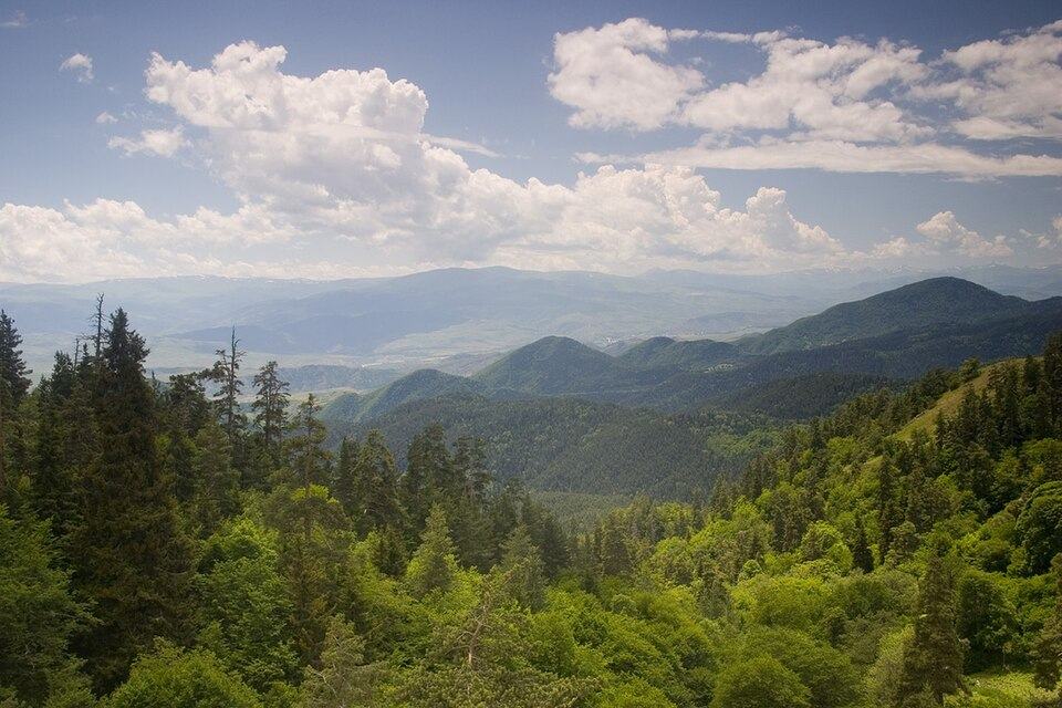
Borjomi-Kharagauli, with its surrounding reserves about 107,600 ha of protected land, is among the largest parks in Georgia and spreads over the forested Meskheti range from the Borjomi gorge west into Imereti's Kharagauli district. Of its marked trails, number 2, named after St Andrew the First-Called, is the most complete crossing: it starts in the dry pine forests above the Mtkvari, climbs to alpine meadows on the park's highest summit and descends through wet Colchic forest to the western boundary. Legend says St Andrew raised an iron cross on one of the summits along the way, the Rkinis Jvari.
The trail is open to walkers and to riders, is waymarked throughout, and has three tourist and ranger shelters, so you need no tent. The park rates it hard; on our scale it is a 3, with daily climbs up to about 1,150 m and one long descent day, but no technical ground. Outside the high Caucasus, few multi-day routes in Georgia are as well organised or as long in season.
Walkers short on time can choose trail number 1, the Nikoloz Romanov Trail from Likani on the edge of Borjomi, which shares the last two stages; see alternatives below.
Highlights
- Sametskhvario summit (2,642 m), the park's highest point
- Rkinis Jvari, the iron cross linked to St Andrew
- Moving from pine forest to alpine meadow to lush Colchic forest in four days
- Bezoar goat enclosure near Atskuri
- Staffed shelters: a hut-to-hut trek with no tent needed
Trail facts
Last checked Oct 2026 by the Maspindzeli team. Mountain conditions change: ask us before you go.
Is this right for you?
Three quick questions for a friendly second opinion. Nothing is sent anywhere.
Stage by stage
| Day | From → to | Distance | Up | Down | Hours | Highest |
|---|---|---|---|---|---|---|
| 1 | Atskuri ranger station → Amarati tourist shelter | 16 km | +1,150 m | −250 m | 6-7 h | 2,150 m |
| 2 | Amarati tourist shelter → Sametskhvario shelter | 9 km | +900 m | −300 m | 4-5 h | 2,642 m |
| 3 | Sametskhvario shelter → Sakhvlari tourist shelter | 19 km | +200 m | −1,675 m | 7 h | 2,500 m |
| 4 | Sakhvlari tourist shelter → Marelisi ranger station | 10 km | +100 m | −585 m | 4-5 h | 1,025 m |
01Atskuri to Amarati shelterAtskuri ranger station → Amarati tourist shelter · 16 km · 6-7 h
From the ranger station the path runs up a side valley and, after about a kilometre, passes the enclosure of the park's bezoar goat breeding project. Twenty minutes later it leaves the valley floor and climbs a narrow path up the mountainside through pine and spruce. After about three hours the forest opens to the first wide views of the Lesser Caucasus. The afternoon follows the slopes with views on both sides before dropping to Amarati shelter, at about 1,900 m, near summer shepherd camps.
02Amarati to Sametskhvario over the summitAmarati tourist shelter → Sametskhvario shelter · 9 km · 4-5 h
Climb back to the ridge and head north-east over open subalpine meadow, crossing Mount Megruki, from which Sametskhvario comes into view. Descend along the connecting saddle and climb to the summit at 2,642 m, the highest point in the park, with the Greater Caucasus visible on clear days. The small ranger shelter below the top has only a couple of beds, so confirm your booking or carry a tent for the designated pitch.
03Sametskhvario to Sakhvlari via Rkinis JvariSametskhvario shelter → Sakhvlari tourist shelter · 19 km · 7 h
A long day that loses height almost all the way. The path runs along the ridge to Rkinis Jvari, the 'iron cross' of the St Andrew legend, then enters beech forest and drops steadily into the Colchic zone, where the vegetation becomes greener and damper by the hour. Sakhvlari shelter, at about 1,025 m, is shared with walkers on the Nikoloz Romanov Trail.
04Sakhvlari to MarelisiSakhvlari tourist shelter → Marelisi ranger station · 10 km · 4-5 h
The easiest stage, down the gorge of the Arjala (Arjola) river to Marelisi. The path crosses the stream several times; ask at the visitor centre before you start whether all the footbridges are intact, especially after spring floods. Sign out at the ranger station.
Practical information
Getting there
Minibuses leave Tbilisi Didube for Borjomi roughly hourly between 08:00 and 19:00, about 2.5 to 3 hours for 12 to 15 GEL (about $5) in 2026. Register at the visitor centre, then continue 27 km south-west along the Mtkvari to Atskuri: expect to pay a taxi driver 40 to 60 GEL ($15 to $22) for this leg, or flag down an Akhaltsikhe-bound minibus for a few lari and ask for the Atskuri park entrance. A private driver from Tbilisi straight to Atskuri, with the stop in Borjomi, is around 230 to 280 GEL (about $85 to $105).
Getting back
Marelisi is a village in the Kharagauli district on the western side of the park, about 17 km from Kharagauli town. Book a taxi through the visitor centre or your last shelter's ranger: about 30 to 40 GEL (about $11 to $15) to Kharagauli, where trains and minibuses run toward Tbilisi and Kutaisi. A driver all the way back to Borjomi via Khashuri takes about 2 hours; budget 150 to 200 GEL for the car, or $55 to $75; to Kutaisi it is a little less.
Water
The shelters have no running water, so ask the visitor centre which springs near each one are flowing that month. Day 1 follows a stream at first, then climbs onto dry slopes; carry 2 litres. The ridge on days 2 and 3 has few sources, so fill up at every spring and treat the water. Day 4 runs beside the river all day.
Phone signal
Reasonable in the Borjomi gorge and around Atskuri, intermittent on the higher ridges (the summit area of Sametskhvario often has a signal), and poor in the deep forest valleys on days 3 and 4. The shelters have small solar systems for lights and phone charging.
Nearest help
Dial 112, and call the park's visitor centre, whose rangers know the shelters. Borjomi has a hospital at the start; Kharagauli and Zestaponi are closest to the finish. Rangers staff some shelters and stations in season, which makes this the best-supported multi-day trek in the Lesser Caucasus.
Permits
Registration is compulsory. Before setting out, sign in at the national park visitor centre at 23 Meskheti Street in Borjomi (or the Kharagauli centre if you walk in reverse), give your route and dates, and book and pay for shelter beds there. The ranger stations at Atskuri and Marelisi only log you in and out. Shelter beds cost about 20 GEL (about $7) per person per night in 2026, 10 GEL for students; a tent pitch is about 5 GEL and tent hire about 10 GEL a day. Wild camping outside the shelters and marked sites is not allowed.
Gear and safety
What to bring
- Sleeping bag: shelters provide bunks and mattresses but not always bedding
- Food for four days and a stove, unless you have arranged meals with the rangers
- Water filter or tablets and 2 litres of capacity
- Waterproof jacket and warm layer for the summit day
- Hiking boots and trekking poles for the 1,675 m descent on day 3
- Headtorch, power bank and cash for shelter fees
- Printed park map from the visitor centre as a backup to your phone
Stay safe
- Register before you go and sign out at Marelisi: rangers check the log and will look for overdue walkers.
- Brown bears and wolves live in the park. Make noise in dense forest, keep food inside the shelter and never feed animals.
- Ticks are common in long grass in May and June; check yourself every evening.
- The summit ridge on day 2 is exposed. In thunderstorms or thick fog, wait at Amarati rather than cross Sametskhvario.
- River crossings on day 4 can be dangerous after heavy rain; wait for the level to fall.
- Trail 1, Nikoloz Romanov Trail: Likani ranger station (930 m, 5 km from the visitor centre) to Marelisi, 43 km over 3 days via Lomismta shelter and the summit of Lomis Mta (2,198 m) with its St George church, then Sakhvlari. Rated moderate by the park and easier to reach from Borjomi.
- Trail 3, Panorama Trail: a 34 km two-day loop from Atskuri using the first stage of the St Andrew Trail to Amarati, returning to Atskuri. Good if you cannot arrange transport from Marelisi.
- Trail 12, Likani Valley: a 7 km, 4-hour loop from Likani over the Chitakhevi ridge with views of the Borjomi gorge, for a single free day.
- Trail 6, Footprint Trail: 13 km and about 6 hours from Likani to the Kvabiskhevi valley, joining the Romanov trail for the first climb.
- Reverse direction: start at Marelisi and register in Kharagauli. You then face the 1,675 m climb to Sametskhvario on day 2.
- On horseback: the trail is open to riders; ask the visitor centre to arrange horses and a horseman.
Emergency number in Georgia: 112. Tell your guesthouse your plan before you set off.
Places on and near the route
Tours that include this trail
St Andrew Trail, Borjomi-Kharagauli National Park: FAQ
How long is the St Andrew Trail in Borjomi?
It measures 54 km, normally walked in four stages of 16, 9, 19 and 10 km between the Atskuri and Marelisi ranger stations.
Do I need to register to hike in Borjomi-Kharagauli National Park?
Yes. Register at the visitor centre in Borjomi or Kharagauli before any multi-day trail, and book your shelter beds there.
How much do the park shelters cost?
A bunk is roughly 20 GEL a night in 2026, half that for students, while pitching your own tent at a marked site costs around 5 GEL. Prices are set by the Agency of Protected Areas.
Which is easier, the St Andrew Trail or the Romanov Trail?
The Nikoloz Romanov Trail (trail 1) is shorter, lower and rated moderate: 43 km over three days, highest point 2,198 m. The St Andrew Trail (trail 2) is longer and climbs to 2,642 m.
When is the best time to walk the St Andrew Trail?
Any time from June until the middle of October. The finest weeks are usually the turn of September into October, when the beech woods change colour and the weather is calm.
Last checked Oct 2026 by the Maspindzeli team. Mountain conditions change: ask us before you go.