Mestia to Ushguli Trek
Upper Svaneti's village-to-village classic: four stages and about 57 km from Mestia to Ushguli, crossing two high ridges and the Chkhutnieri Pass at roughly 2,720 m, with a family guesthouse every night. This page is the route card; our long-form trek guide covers the villages, packing and planning in depth.
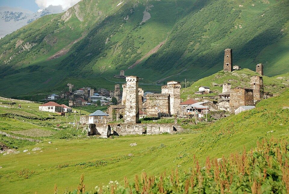
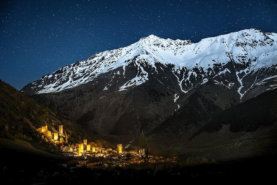 Mestia to Ushguli TrekPhoto: Q-lieb-in, CC BY-SA 4.0
This is the structured route card for the trek: numbers per stage, water, phone coverage, transport and fallback options, all on one page. For the story of the villages, the guesthouses and how to plan the week around the walk, read our full Mestia to Ushguli trek guide alongside it.
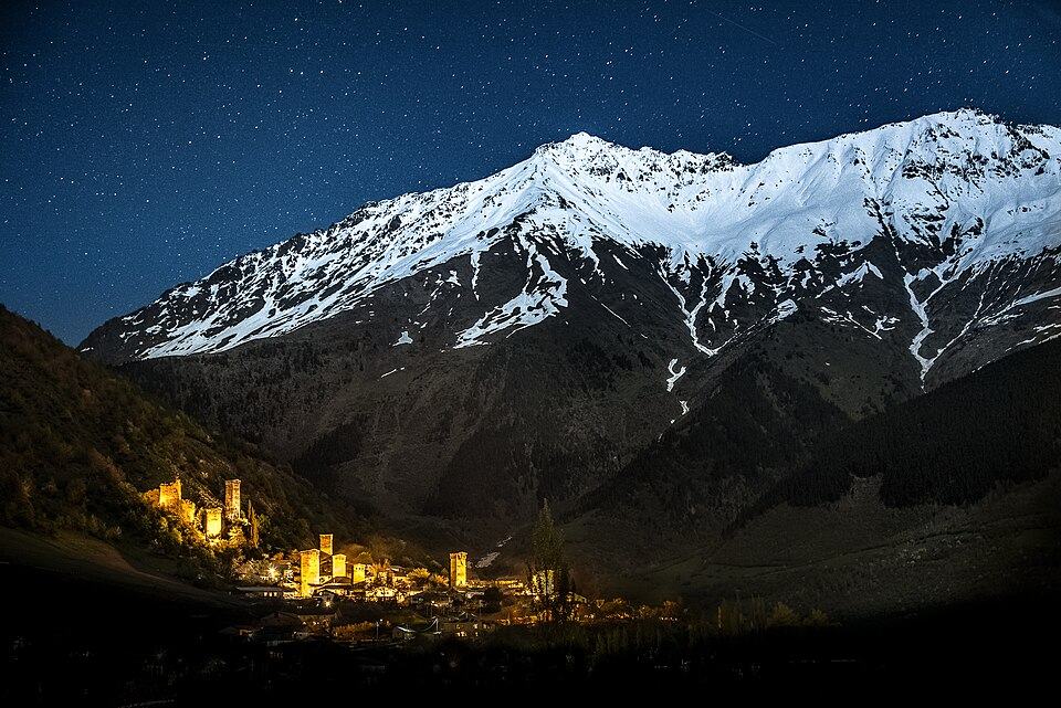
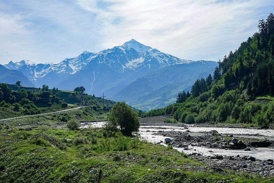
The route links four communities of Upper Svaneti, the UNESCO-listed highland in Georgia's north-west. You leave Mestia on foot, drop into the Mulakhi valley at Zhabeshi, climb past the Tetnuldi ski lifts to tiny Adishi, ford the Adishchala river and cross the Chkhutnieri Pass to Iprali, then follow the Enguri up to the towers of Ushguli below Shkhara. Total figures: about 57 km, 3,100 m up and 2,400 m down.
We grade it 3 (Challenging) on our five-point scale. Each day is a normal mountain walk on clear paths, but day 3 combines 18 km, a glacial river crossing and the highest pass, and the weather above 2,500 m turns fast. No tent, stove or technical skill is needed, and luggage can travel by car between guesthouses.
Highlights
- Ushba and Tetnuldi from the open ridge on day 1
- Adishi, a roadless tower village at about 2,040 m
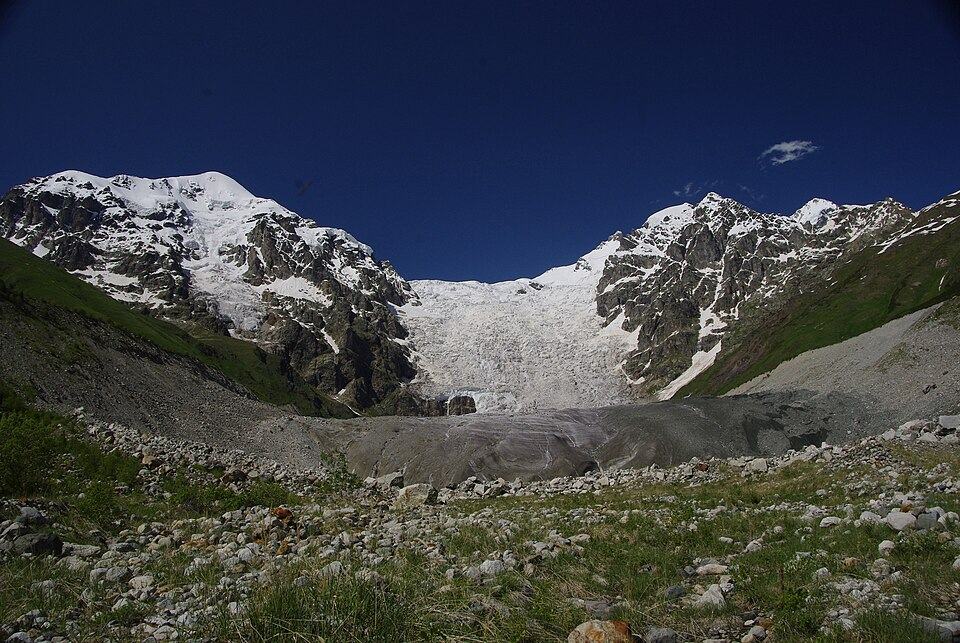
- The Adishi Glacier icefall seen from the Chkhutnieri Pass
- Riding a horse across the Adishchala river
- Arriving under Shkhara among the towers of Ushguli
Trail facts
Last checked Oct 2026 by the Maspindzeli team. Mountain conditions change: ask us before you go.
Is this right for you?
Three quick questions for a friendly second opinion. Nothing is sent anywhere.
Stage by stage
| Day | From → to | Distance | Up | Down | Hours | Highest |
|---|---|---|---|---|---|---|
| 1 | Mestia → Zhabeshi | 15.5 km | +800 m | −500 m | 5-6 h | 2,250 m |
| 2 | Zhabeshi → Adishi | 10.6 km | +900 m | −530 m | 5-6 h | 2,680 m |
| 3 | Adishi → Iprali | 18 km | +860 m | −1,070 m | 7-9 h | 2,720 m |
| 4 | Iprali → Ushguli | 12.5 km | +550 m | −300 m | 4-5 h | 2,200 m |
01Mestia to Zhabeshi over the eastern ridgeMestia → Zhabeshi · 15.5 km · 5-6 h
Leave Seti Square heading east past the airport road and pick up the farm track that climbs above the Lanchvali district. Waymarks are sparse for the first hour, so keep the track on your phone. The climb levels out on a broad grassy shoulder with Ushba behind you and Tetnuldi ahead, which is the best lunch spot of the day. A long forest descent then takes you down to the Mulkhura river at Zhabeshi; Chvabiani, slightly further on, also has rooms. If cloud sits on the ridge, follow the valley road through Mulakhi instead: about the same distance, less climbing, no views.
02Zhabeshi to Adishi below TetnuldiZhabeshi → Adishi · 10.6 km · 5-6 h
Cross the Mulkhura and start climbing almost immediately. The path zigzags through birch and then open meadow, passing under the chairlifts of the Tetnuldi resort, and tops out on the ridge at roughly 2,650 to 2,700 m depending on the line you take. There is no water on the upper half, so fill up in the village. From the crest, Tetnuldi's glaciers fill the view, and the descent to Adishi (about 2,040 m) is short but steep enough to make poles worthwhile. Arrive early in August: Adishi has only a handful of guesthouses.
03Adishi to Iprali via the ford and the Chkhutnieri PassAdishi → Iprali · 18 km · 7-9 h
Start by 07:30. An easy hour up the Adishchala valley brings you to the crossing point, where the river is fast, knee to thigh deep and very cold; meltwater rises through the day. Most walkers ride across with one of the horsemen who wait there in season; the going rate per rider is roughly 20 to 30 GEL in 2026 (around $7 to $11). On the far bank the path climbs in tight bends to the Chkhutnieri Pass, around 2,720 m, facing the icefall of the Adishi Glacier. The descent into the Khaldechala valley is long, first on grass, then on a jeep track past Khalde to Iprali or neighbouring Lalkhori. Tired walkers can stop in Khalde and shorten the day by about 4 km.
04Iprali to Ushguli along the EnguriIprali → Ushguli · 12.5 km · 4-5 h
The gentlest stage. A dirt road and footpaths follow the Enguri upstream through Davberi and past the church at Kala, gaining height gradually. There is little shade and some traffic, so start early on hot days. Shkhara's 5,000 m wall appears ahead long before you reach the first towers of Murqmeli and Chazhashi. Fit walkers who want a harder finish can take the Lagem Pass variant from Khalde instead (see alternatives).
Practical information
Getting there
Most walkers reach Mestia through Zugdidi. The 08:15 train from Tbilisi reaches Zugdidi in the early afternoon (about 16 GEL, about $6, in second class, 2026), and vans to Mestia wait outside the station: about 40 GEL (about $15), 3.5 to 4 hours. Direct services from Tbilisi Didube take 9 to 10 hours for about 60 GEL (about $22). Vanilla Sky flies small planes from Natakhtari, near Tbilisi, to Mestia for about 90 to 120 GEL (about $33 to $45) when the weather allows. A private car with driver from Kutaisi costs roughly 450 to 550 GEL (about $165 to $205), from Tbilisi about 650 to 800 GEL (about $240 to $295).
Getting back
Shared jeeps and vans leave Ushguli for Mestia most summer mornings and afternoons: about 40 to 50 GEL (about $15 to $19) a seat, or 200 to 250 GEL (about $75 to $95) for the whole car, 1.5 to 2 hours on the paved road. From July to about mid-October a road also runs south across the Zagari Pass toward Lentekhi, reaching Kutaisi in about 4 to 5 hours, which avoids doubling back; a 4x4 to Kutaisi costs in the region of 450 to 550 GEL (roughly $165 to $205). All prices are approximate for 2026.
Water
Plenty, but treat it. Guesthouses fill bottles with tap or spring water each morning, and side streams cross the path on every stage. Cattle and horses graze up to the passes, so filter or purify anything you take from a stream. The longest dry stretch is the climb out of Zhabeshi on day 2: carry 1.5 to 2 litres from the village.
Phone signal
Good in Mestia, Zhabeshi, Iprali and Ushguli on Magti and Silknet. Adishi has weak or no mobile coverage, though some guesthouses there offer Wi-Fi. The open ridges on days 1 and 2 usually pick up a signal; the upper Adishchala valley below the pass often does not. Magti tends to reach furthest.
Nearest help
Dial 112 (ambulance, police and rescue). Mestia has a small hospital and an Aversi pharmacy; serious cases go down to Zugdidi, about 3 hours by road. On day 3 the nearest road-accessible point is Khalde or Iprali, so a casualty above the ford would be carried or ridden out by horse.
Permits
None. There is no park fee, no permit and no checkpoint on the standard route. Carry your passport anyway, as you would anywhere in the high Caucasus, and tell your guesthouse host each morning where you plan to sleep that night.
Gear and safety
What to bring
- Broken-in hiking boots and a separate pair of light shoes or sandals for the ford if you wade
- Trekking poles for the descents into Adishi and off the Chkhutnieri Pass
- Waterproof jacket and warm fleece: afternoon storms are common in July and August
- Sun hat, sunglasses and high-factor sunscreen for the open ridges
- Water filter or purification tablets
- Cash in GEL for guesthouses, horses and transport; there is no ATM between Mestia and Ushguli
- Offline map with the route loaded, plus a power bank, since some guesthouses have limited sockets
- Small first-aid kit with blister plasters
Stay safe
- Ford the Adishchala early, before the midday melt raises it, and never wade alone after heavy rain; wait or ride.
- Do not attempt the Chkhutnieri Pass in thick fog or thunderstorms. Adishi hosts will tell you if the pass is in condition; an extra night there is cheap insurance.
- Before early July, old avalanche snow can lie in the gullies below the pass. Without experience on snow, go with a guide or wait.
- Shepherd dogs guard flocks near Zhabeshi and on the pass meadows. Slow down, keep a pole between you and the dog and let the shepherd call it off.
- Paths look obvious until cloud comes down. Keep your offline map open and check it at every junction on days 1 and 3.
- Three days: take a taxi from Mestia to Zhabeshi (about 60 to 80 GEL, about $22 to $30, per car in 2026) and start with the Tetnuldi ridge.
- Lagem Pass finish: from Khalde climb to the Lagem Pass at about 3,000 m and drop straight into Ushguli, roughly 15 km and 8 hours. Harder than the valley stage, with big views of Shkhara; only in settled weather.
- Tsvirmi variant: walk day 1 from Mestia to Tsvirmi through quiet villages south of the main route, then rejoin toward Adishi; it adds roughly a day.
- Bad weather on day 1: use the valley road through Mulakhi. Bad weather on day 3: stay in Adishi, or arrange a 4x4 back to Mestia and on to Ushguli by road.
- Add a fifth day in Ushguli and walk up the Enguri to the Shkhara Glacier, roughly 16 km there and back on easy ground.
- Reverse direction (Ushguli to Mestia) works, but arrange the horse crossing in advance, because the horsemen are based on the Adishi side.
Emergency number in Georgia: 112. Tell your guesthouse your plan before you set off.
Places on and near the route
Tours that include this trail
Mestia to Ushguli Trek: FAQ
What distance is the Mestia to Ushguli trek?
About 57 km over four days, with roughly 3,100 m of ascent and 2,400 m of descent. Stage lengths are 15.5, 10.6, 18 and 12.5 km.
Do I need a guide for Mestia to Ushguli?
Not in July to mid-September if you are used to mountain walking and carry an offline map. A guide is worth it in June or October, in poor weather, or if you want someone to handle the ford, luggage and bookings.
Can I do the trek in 3 days?
Yes. Skip day 1 by taxi to Zhabeshi, or walk days 3 and 4 as one very long day from Adishi to Ushguli if you are fast. Two-day versions exist but leave no margin for weather.
How much does the trek cost in 2026?
Budget about 100 to 130 GEL (about $37 to $48) per person per night for half board in guesthouses, 20 to 30 GEL for the horse at the ford, and 40 to 50 GEL for a seat back to Mestia. Prices are approximate.
Where can I read more about the villages and planning?
Our Mestia to Ushguli trek guide covers the villages, guesthouse tips, packing and side trips in detail; this page keeps the route data in one place.
Last checked Oct 2026 by the Maspindzeli team. Mountain conditions change: ask us before you go.