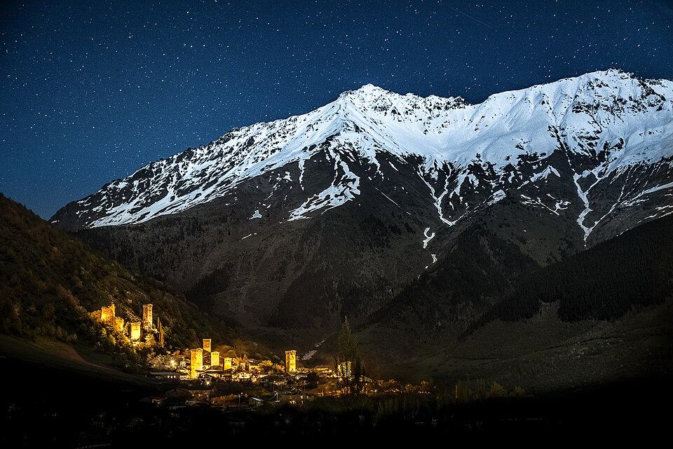
Guli Pass Trek: Mestia to Mazeri
A full-day crossing from Mestia over the Guli Pass (about 2,955 m) to Mazeri at the foot of Ushba: around 21 km, 1,750 m up and 1,550 m down, with some of the closest Ushba views in Svaneti. For experienced, acclimatised hikers only.
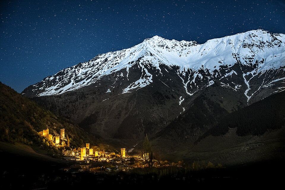 MestiaPhoto: Q-lieb-in, CC BY-SA 4.0
This route links Mestia with the Becho valley over the high ground that separates them, the same ridge whose southern slopes hold the Koruldi Lakes. It climbs the Koruldi jeep track, leaves it on the plateau, drops into a steep ravine, then rises to the Guli Pass at roughly 2,950 m, where the north face of Ushba appears close enough to touch. The descent runs past the ruined church and houses of the deserted village of Guli to Mazeri.
We grade it 4 (Hard). It is 9 to 11 hours of walking, the climbing from Mestia comes to about 1,750 m, the ravine crossing is awkward and the path on the far side of the pass is steep and loose. Do it only in a stable forecast, after at least one acclimatisation day such as the Koruldi Lakes.
Many walkers prefer to start in Mazeri and finish in Mestia: Mazeri is roughly 200 m higher, so you save that much climbing, and you end the day in town with transport and restaurants. The stage notes below follow the Mestia to Mazeri direction; reverse them if you start in the Becho valley.
Highlights
- Ushba's north and south summits seen face on from the pass
- The Koruldi plateau and lakes on the way up
- Ruined church and houses of abandoned Guli
- Arriving on foot in Mazeri rather than by road
Trail facts
Last checked Oct 2026 by the Maspindzeli team. Mountain conditions change: ask us before you go.
Is this right for you?
Three quick questions for a friendly second opinion. Nothing is sent anywhere.
Stage by stage
| Day | From → to | Distance | Up | Down | Hours | Highest |
|---|---|---|---|---|---|---|
| 1 | Mestia → Mestia Cross | 3.5 km | +750 m | −0 m | 2-2.5 h | 2,200 m |
| 1 | Mestia Cross → Guli Pass | 7.5 km | +900 m | −150 m | 3.5-4 h | 2,955 m |
| 1 | Guli Pass → Guli | 5 km | +50 m | −950 m | 2-2.5 h | 2,955 m |
| 1 | Guli → Mazeri | 5 km | +50 m | −450 m | 1.5-2 h | 2,000 m |
01Mestia to the Mestia CrossMestia → Mestia Cross · 3.5 km · 2-2.5 h
Climb the steep footpath north of town to the viewpoint cross. This is the same start as the Koruldi Lakes hike, and the obvious place to cut the day short with a jeep. Leave by 07:00 at the latest if you walk it.
01Across the plateau and the ravine to the Guli PassMestia Cross → Guli Pass · 7.5 km · 3.5-4 h
Follow the Koruldi track onto the plateau, then branch west before the lakes on a fainter path. The route drops into a deep ravine where the stream crossing and the scramble out on loose ground are the trickiest moves of the day. Beyond it, grassy slopes lead up to the pass. Expect old snow patches here until mid-July. From the saddle, Ushba's twin summits stand directly across the Becho valley. A short detour leads to the grassy top above the pass for a wider view.
01Guli Pass to the abandoned village of GuliGuli Pass → Guli · 5 km · 2-2.5 h
The descent is steep from the start, on loose earth and scree that turns greasy after rain. Poles are essential. Lower down the path enters meadow and then forest, and the stone ruins and small church of Guli appear in a clearing, abandoned decades ago.
01Guli to MazeriGuli → Mazeri · 5 km · 1.5-2 h
Easier walking on forest paths and tracks down into the Becho valley, joining the road at the upper end of Mazeri. Your guesthouse or driver will be waiting near the village centre.
Practical information
Getting there
You start on foot in central Mestia. To save the first 750 m of climbing, hire one of the Mestia jeep drivers to drop you at the cross; the fare is the same as for Koruldi walkers (see that page), and it turns a 10-hour day into an 8-hour one.
Getting back
From Mazeri, pre-arrange a car back over the 25 km of road to Mestia, a 45-minute ride costing much the same as the morning taxi out to Mazeri (prices on the Ushba Glacier page). Better, stay the night in a Mazeri guesthouse and walk to the Ushba Glacier the next day.
Water
Set off from Mestia with at least 2.5 litres each, 3 on a hot day. Apart from a stream in the ravine beyond the Koruldi plateau and small seasonal trickles near the pass, there is nothing reliable until the streams below abandoned Guli. Treat everything; livestock graze high.
Phone signal
Good on the climb above Mestia and usually at the Mestia Cross. Patchy to none in the ravine and on the north side of the pass; it returns as you approach Mazeri. Magti generally holds out longest.
Nearest help
Dial 112. Until the pass, Mestia is the nearest help, with jeep drivers on the Koruldi track in summer. After the pass, Mazeri is closer, about 3 hours on foot; from there Mestia's hospital is 45 minutes by car.
Permits
None for the crossing itself. Carry your passport: you finish in the Becho valley, where the border police patrol near the Russian frontier.
Gear and safety
What to bring
- Sturdy hiking boots; trail runners struggle on the loose descent
- Trekking poles
- A filter plus 2.5 to 3 litres of water each
- Waterproof and warm layers, gloves and a hat: the pass is exposed
- Headtorch in case the day runs long
- Offline map with the route loaded
- Passport
Stay safe
- Not suitable in poor visibility: the path between the plateau and the pass is faint, and the ravine is easy to enter in the wrong place.
- Check the snow before committing to the north side. If the descent from the pass is still snow-covered and you have no ice axe experience, turn back.
- Set a turnaround time: if you are not at the pass by 13:00, return to Mestia.
- Thunderstorms build over the ridge on many July and August afternoons; the pass is no place to be in one.
- Go with a guide unless you are confident navigating off waymarked paths.
- Reverse direction, Mazeri to Mestia: about 200 m less climbing and you finish where transport is easy.
- Shorter day: jeep to the Mestia Cross, saving about 3.5 km and 750 m.
- Bad weather: drop the crossing and do the Koruldi Lakes as an out-and-back, or the low-level Chalaadi Glacier walk.
- Two-day version: camp near the Koruldi Lakes and cross the pass early next morning, when the light on Ushba is best.
Emergency number in Georgia: 112. Tell your guesthouse your plan before you set off.
Places on and near the route
Guli Pass Trek: Mestia to Mazeri: FAQ
How hard is the Guli Pass trek?
Hard. It is about 21 km with roughly 1,750 m of ascent, a steep loose descent and a tricky ravine crossing. Fit, experienced walkers need 9 to 11 hours.
Which direction is better for the Guli Pass?
Starting in Mazeri saves about 200 m of climbing and ends in Mestia, where you have shops and transport. Starting in Mestia lets you use a jeep for the first climb.
Can I do the Guli Pass without a guide?
Experienced walkers with good navigation do it alone in clear, settled weather. Everyone else should hire a guide, because the route is faint in places and there is no phone signal on the far side.
Last checked Oct 2026 by the Maspindzeli team. Mountain conditions change: ask us before you go.