Abudelauri Lakes Day Hike from Roshka
The one-day way to see the three coloured Abudelauri lakes: from Roshka in Khevsureti up the Abudelauri valley to the Blue and Green lakes and the White Lake under the Chaukhi walls, then back. Allow 6 to 7 hours for roughly 14 km with 850 m of climbing.
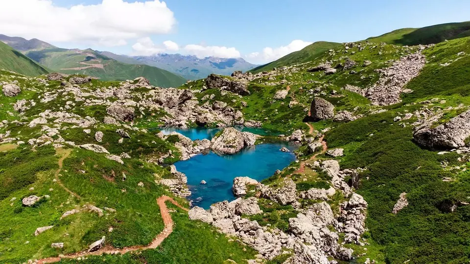 Abudelauri Lakes, KhevsuretiPhoto: georgia.travel
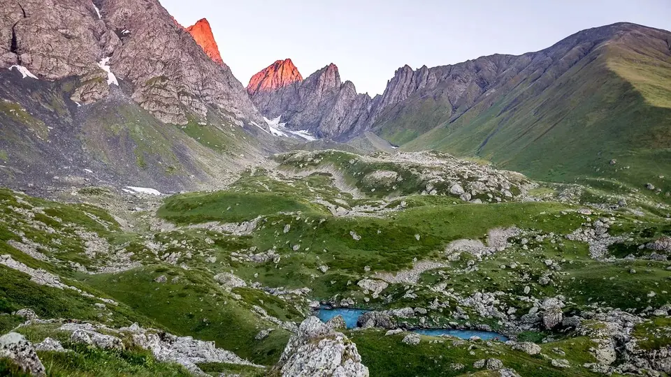
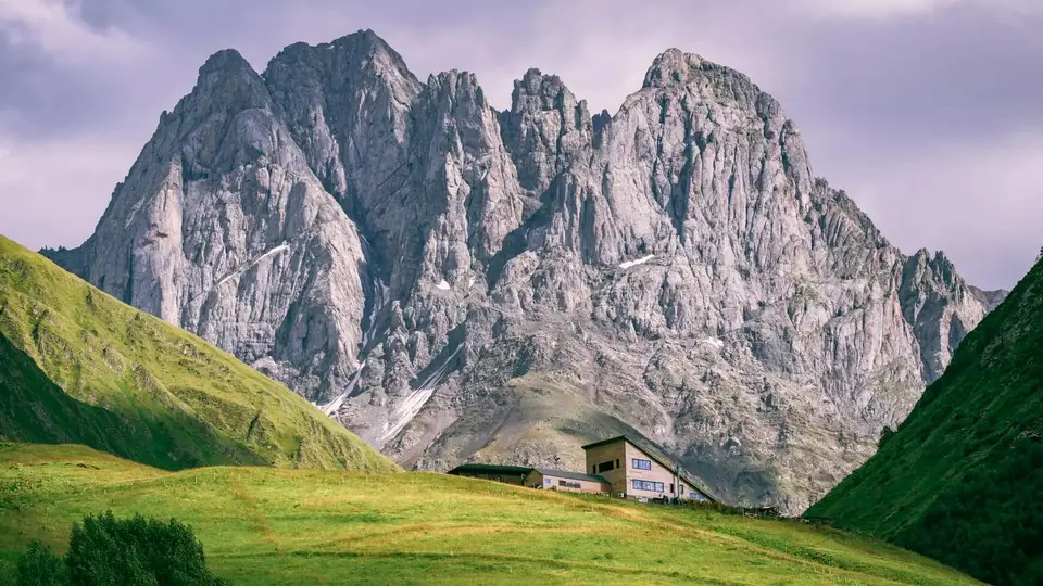
The Abudelauri lakes sit in a hanging valley on the eastern side of the Chaukhi massif. Each has its own colour: the Blue Lake is small and clear, the Green Lake takes its tint from algae and the meadows around it, and the White Lake, highest of the three, is milky with rock flour from the snowfields above. Most people meet them at the end of the two-day crossing from Juta, but you can reach them in a day from Roshka without climbing any pass.
We grade the full outing 3: it is a steady climb of about 600 m to the Green Lake on a clear path, then a steeper, rockier pull of about 250 m to the White Lake. If you stop at the Green and Blue lakes the walk drops to about 12 km and 600 m, closer to a 2.
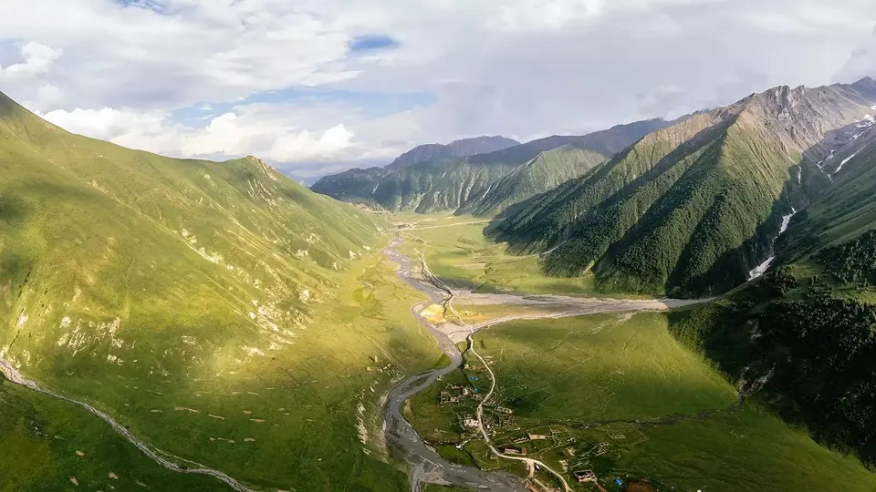
Roshka itself is worth the trip: a village of flat-roofed stone houses on a steep slope above the Roshkistskali, with a handful of family guesthouses. The hard part is the drive, so plan the hike around a night there.
Highlights
- Three lakes of different colours in one walk
- Close views of the limestone towers of Chaukhi
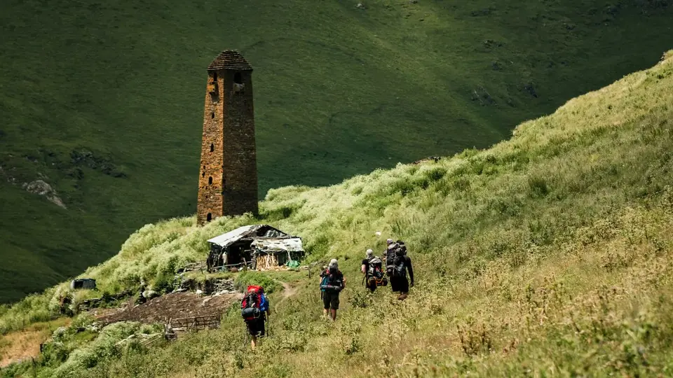
- Stone houses and old towers in Roshka village
- Alpine flowers in July
- No pass to cross, so a shorter and safer alternative to the Juta crossing
Trail facts
Last checked Oct 2026 by the Maspindzeli team. Mountain conditions change: ask us before you go.
Is this right for you?
Three quick questions for a friendly second opinion. Nothing is sent anywhere.
Stage by stage
| Day | From → to | Distance | Up | Down | Hours | Highest |
|---|---|---|---|---|---|---|
| 1 | Roshka → Blue Lake | ~5 km | ~+520 m | −0 m | 2-2.5 h | ~2,520 m |
| 1 | Blue Lake → Green Lake | ~1 km | ~+80 m | −0 m | 0.5 h | ~2,600 m |
| 1 | Green Lake → White Lake | ~1.5 km | ~+250 m | −0 m | 1-1.25 h | ~2,850 m |
| 1 | White Lake → Roshka | ~6.5 km | +0 m | ~−850 m | 2-2.5 h | ~2,850 m |
01Roshka up the Abudelauri valleyRoshka → Blue Lake · ~5 km · 2-2.5 h
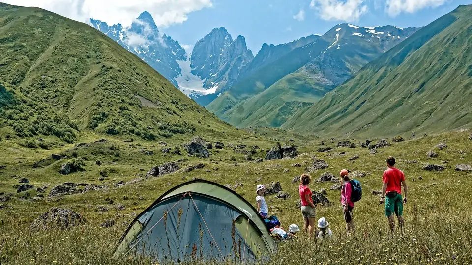
Walk out of the top of Roshka on the farm track, which soon becomes a footpath heading west into the Abudelauri valley, keeping the stream on your left. The path climbs gently at first through pasture and patches of birch and rhododendron, with the grey wall of Chaukhi growing ahead. A short detour to the left leads to the small Blue Lake.
01Blue Lake to the Green LakeBlue Lake → Green Lake · ~1 km · 0.5 h
A few minutes above the Blue Lake you reach the Green Lake, the largest of the three, ringed by grass and boulders. It is the natural lunch spot and the place to turn round if the weather is closing in.
01Up to the White LakeGreen Lake → White Lake · ~1.5 km · 1-1.25 h
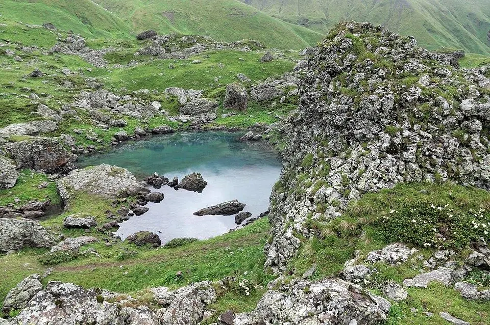
The path continues up rocky ground and old moraine toward the foot of the cliffs. It is steeper and less obvious than below, with snow patches into July. The White Lake lies in a bowl right under the Chaukhi faces, pale and cold, often with ice floating on it in early summer.
01Back down to RoshkaWhite Lake → Roshka · ~6.5 km · 2-2.5 h
Return by the same route. Go carefully on the loose section below the White Lake, then enjoy an easy descent down the valley with Roshka's towers and the Khevsureti hills in front of you.
Practical information
Getting there
Roshka lies about 110 to 120 km from Tbilisi. Drive north on the Military Road, turn off at the Zhinvali reservoir and follow the Aragvi valley road toward Barisakho, then take the side road up to Roshka. The last 7 to 8 km to the village are rough gravel with tight bends: use a 4x4 or at least a high-clearance car, and avoid it after heavy rain. Allow 3 to 3.5 hours from Tbilisi. In 2026 a private 4x4 and driver from Tbilisi runs to roughly 280-380 GEL ($105-140) for a one-way transfer, or about 450 to 600 GEL (about $165 to $220) for a return day with the driver waiting. Without a car, take the daily minibus from Didube in Tbilisi to Barisakho (it leaves in the late afternoon, about 10 to 15 GEL or $4 to $6) and ask a guesthouse in Roshka to collect you, about 100 to 150 GEL (about $37 to $55) per car. With public transport you need two nights in Roshka.
Getting back
Return to Roshka by the same path. There is no bus from the village, so arrange your driver before you set off. A day trip from Tbilisi means about 7 hours of driving on top of the walk, which is why we suggest sleeping in Roshka or Barisakho the night before.
Water
The Abudelauri stream runs beside most of the path and side springs come down from the slopes, so you can refill on the way. Flocks graze the whole valley in summer, so filter or treat it. Start with 1.5 litres from Roshka; above the Green Lake the White Lake section is dry apart from snowmelt.
Phone signal
Weak signal in parts of Roshka, usually none once you are in the Abudelauri valley. Download an offline map before you leave Barisakho, and tell your guesthouse or driver when you expect to be back.
Nearest help
Call 112 from any spot with reception. Roshka guesthouses can call for help on the village connection. The nearest clinic is around Barisakho, and the nearest hospital is in Dusheti or Tbilisi, 2.5 to 3.5 hours away. A rescue from the upper valley may need a helicopter.
Permits
No permit and no entry fee in 2026 as far as we know. The valley is outside the restricted strip along the Russian border. Carry your passport anyway: police occasionally check cars on the Khevsureti road.
Gear and safety
What to bring
- Sturdy boots: the stretch up to the White Lake is rough and stony
- Rain jacket and a warm layer: the lakes lie at 2,500 to 2,850 m and the wind off Chaukhi is cold
- Water filter or tablets, plus 1.5 litres to start
- Sun hat and sunscreen: there is little shade above the village
- Offline map and a charged power bank
- Packed lunch from your guesthouse; nothing is sold beyond Roshka
Stay safe
- Thunderstorms build over Chaukhi on summer afternoons. Aim to leave the White Lake by early afternoon.
- Sheepdogs guard the flocks in the valley. Keep your distance from the sheep, walk slowly and ask the shepherd to call the dogs if they approach.
- Below the White Lake the ground is loose and can hold hard snow until July; turn back at the Green Lake if you are not sure of your footing.
- Cloud can fill the valley quickly. The path is easy to follow down along the stream, but stay together.
- The Roshka road is narrow and slippery after rain. Drive it in daylight and leave it to an experienced local driver if you are unsure.
- Shorter: turn round at the Green Lake after seeing the Blue Lake: roughly 12 km return, 600 m up, 4 to 5 hours.
- From the end of the drivable track above Roshka, where a 4x4 can take you, the round of the lakes is closer to 10 km.
- Longer: cross the Chaukhi Pass to Juta in the reverse direction of our two-day trek; only for experienced hikers, because the scree climb from this side is steep.
- Bad weather: stay low and visit Roshka and the towers and fortress villages along the Aragvi valley road, or continue toward Shatili if the Datvisjvari Pass is open.
Emergency number in Georgia: 112. Tell your guesthouse your plan before you set off.
Places on and near the route
Abudelauri Lakes Day Hike from Roshka: FAQ
Can I visit the Abudelauri lakes as a day trip from Tbilisi?
It is possible with a private 4x4, but you spend about 7 hours on the road. A night in Roshka makes the day far more relaxed.
Do I need a 4x4 to reach Roshka?
For the last 7 to 8 km of gravel above the main valley road, yes, or at least a high-clearance car with a confident driver. Ordinary sedans struggle, especially after rain.
Which Abudelauri lake is the most beautiful?
Most walkers love the Green Lake for its colour and setting, but the White Lake under the cliffs is the most dramatic. If you have the energy, see all three.
When are the lakes free of snow?
Usually from late June. The White Lake can keep ice and snow around it into July in a heavy winter.
Last checked Oct 2026 by the Maspindzeli team. Mountain conditions change: ask us before you go.