- The Georgian Military Road covers ~165 km inside Georgia, from Tbilisi to the border post in the Dariali Gorge, and Stepantsminda (Kazbegi) lies at ~154 km.
- Driving straight through, you reach Stepantsminda in about 3 hours. With the main sights, plan 6 to 8 hours one way, or split the road over two days.
- The classic stops are Jvari Monastery, the Zhinvali Reservoir, Ananuri, Pasanauri, Gudauri, the Friendship Monument, the Jvari Pass at ~2,379 m, Sno and Gergeti Trinity Church.
- The road never closes for the season, yet snow and avalanche danger blocked the Gudauri to Kobi stretch completely on 10 to 17 days a year in the five winters from 2021/22.
- Russian army engineers built the present road between 1799 and 1863, through a gorge that Greek and Roman writers already called the Caucasian Gates.
The Georgian Military Road is the mountain highway from Tbilisi north to Stepantsminda (Kazbegi) and the Russian border, ~165 km in all. Most people drive it for the stops along the way. There is a 17th-century fortress on a turquoise lake, a khinkali village and a ski resort. Then come a Soviet mosaic above a deep valley and a pass at ~2,379 m. This guide takes you through every stop worth your time, in order, with its distance from Tbilisi, the driving time and how long to stay.
We measured every distance along the road from Freedom Square in central Tbilisi, so the figures match a car's trip meter. You also get the road's long history, its winter closures and a day plan that dodges the midday clouds. For marshrutkas, shared taxis and fares, read our Tbilisi to Kazbegi guide. For what to do once you arrive, open our Kazbegi travel guide.
What is the Georgian Military Road?
The Georgian Military Road is the historic route over the central Caucasus between Tbilisi and Vladikavkaz in Russia, ~212 km end to end. Inside Georgia it is the S3 international road, Mtskheta to Stepantsminda and Larsi, and part of European route E117.
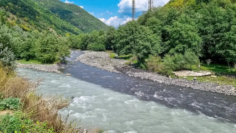
Heading north, it follows the Aragvi through Mtiuleti, the old "land of mountains" around Pasanauri. Above the village of Mleta it climbs in hairpins to Gudauri and crosses the main ridge at the Jvari Pass. On the far side it drops into Khevi, the valley of the Tergi. The river then carves its way north through the Dariali Gorge into Russia.
| The road in numbers | |
|---|---|
| Length inside Georgia | ~165 km from central Tbilisi to the Dariali checkpoint |
| Tbilisi to Stepantsminda | ~154 km, about 3 hours without stops |
| Highest point | Jvari Pass, ~2,379 m |
| Starting height | Tbilisi, ~430 m |
| Rivers | Aragvi south of the pass, Tergi (Terek) north of it |
| Official name | S3 Mtskheta-Stepantsminda-Larsi road, part of E117 |
| Season | Open all year, with short closures over the pass in winter |
Georgian Military Road stops at a glance: km and drive times
Here are the stops in the order you reach them heading north. Times are for driving only, at a steady pace in light traffic. Trucks, weather and photo breaks will stretch them.
| Stop | km from Tbilisi | Drive from Tbilisi | Altitude | Time to allow |
|---|---|---|---|---|
| Jvari Monastery (side road) | ~21 | 25-30 min | ~650 m | 30-45 min |
| Bazaleti Lake (detour near Dusheti) | ~45, then a few km | about 50 min | 878 m | 1 h or more |
| Zhinvali dam, Khevsureti turn-off | ~56 | about 1 h | 5 min | |
| Zhinvali Reservoir viewpoint | ~60 | about 1 h | ~800 m | 10-15 min |
| Ananuri Fortress | ~65 | 1 h 05-1 h 15 | ~800 m | 45 min-1 h |
| Pasanauri | ~87 | about 1 h 30 | 1,050 m | 1 h for lunch |
| Mleta, foot of the hairpins | ~110 | about 1 h 55 | photo stop | |
| Gudauri | ~121 | about 2 h 10 | ~2,200 m | 15 min-1 h |
| Friendship Monument | ~125 | about 2 h 15 | 20-30 min | |
| Jvari Pass | ~127 | about 2 h 20 | ~2,379 m | 10 min |
| Travertine springs | ~130 | about 2 h 25 | 10-15 min | |
| Kobi (Truso turn-off) | ~136 | about 2 h 35 | ~1,970 m | 5 min |
| Sioni basilica | ~143 | about 2 h 45 | 15-20 min | |
| Sno and the Juta road | ~148 | about 2 h 50 | 20-30 min | |
| Stepantsminda | ~154 | about 3 h | 1,740 m | a night if you can |
| Gergeti Trinity Church | above the town | 3 h 15-3 h 20 | 2,170 m | 1-1.5 h |
| Gveleti Waterfall trailhead | ~161 | about 3 h 10 | ~1,560 m | 1-2 h |
| Dariali Monastery | ~165 | about 3 h 20 | ~1,300 m | 30-45 min |
Short on time? Pick five: Ananuri, the Friendship Monument, the springs below the pass, Sno and Gergeti. Together they cover the whole range of the road, from medieval walls to glacier views, in about four hours of stops.
A short history of the Georgian Military Highway
People crossed the Caucasus here long before anyone laid a road. The Dariali Gorge is the easiest gap in the main ridge. Greek and Roman authors, Strabo and Pliny among them, knew it as the Caucasian Gates. Its name comes from the Persian Dar-i Alan, the Gate of the Alans, a people who once held the plains to the north.
The modern road is Russian work. Russian troops first marched this way in 1769. After the Treaty of Georgievsk in 1783, Pavel Potemkin sent 800 soldiers to widen the track. That October he rode into Tbilisi in a carriage pulled by eight horses. Army engineers began the road in its present form in 1799. In 1801 the Russian Empire annexed the eastern Georgian kingdom of Kartli-Kakheti, and the road became its main link to the north.
General Aleksey Yermolov declared the work complete in 1817, yet building went on until 1863. By then the road had stone bridges, post stations and a surface that impressed foreign visitors. Pushkin crossed it in 1829. Lermontov set the opening chapter of his novel A Hero of Our Time (1840) along its curves. The 1914 Baedeker guide to Russia listed motor buses running from mid-April to mid-October, taking 10 hours for the journey.
Soviet planners added the Zhinvali dam, the Gudauri ski area and the Friendship Monument of 1983. Today the road carries a steady stream of trucks to the Upper Lars crossing. Work is under way on a new road of ~23 km that leaves the old one at Kvesheti and rejoins it at Kobi, skirting the avalanche slopes. Its main tunnel is ~9 km long.
Tbilisi to Ananuri: Jvari, the lake and the fortress (km 0 to 65)
The first hour is the gentle part. You leave Tbilisi northwards along the Mtkvari and reach Mtskheta, Georgia's ancient capital, after ~20 km.
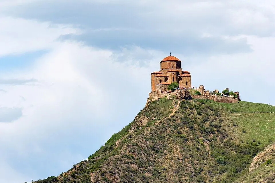
Jvari Monastery (~21 km)
Jvari crowns a hill across the Aragvi from Mtskheta, and a short side road climbs to it from the highway. The church went up around the year 600. From its terrace you look down on the spot where the Aragvi pours into the Mtkvari. Give it 30 to 45 minutes, or keep it for a separate Mtskheta day trip.
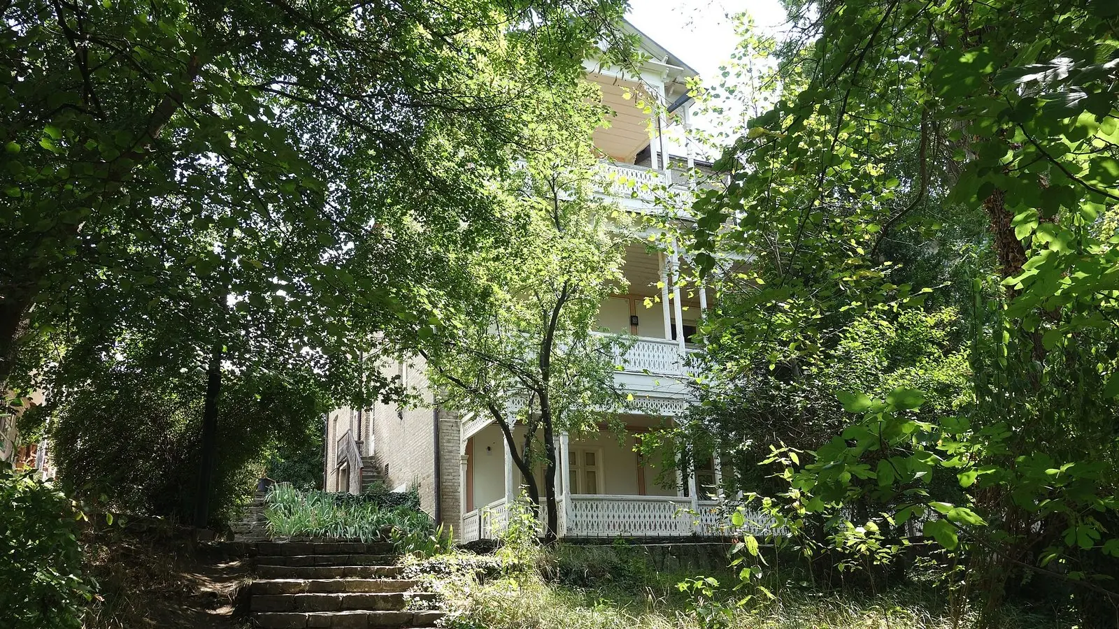
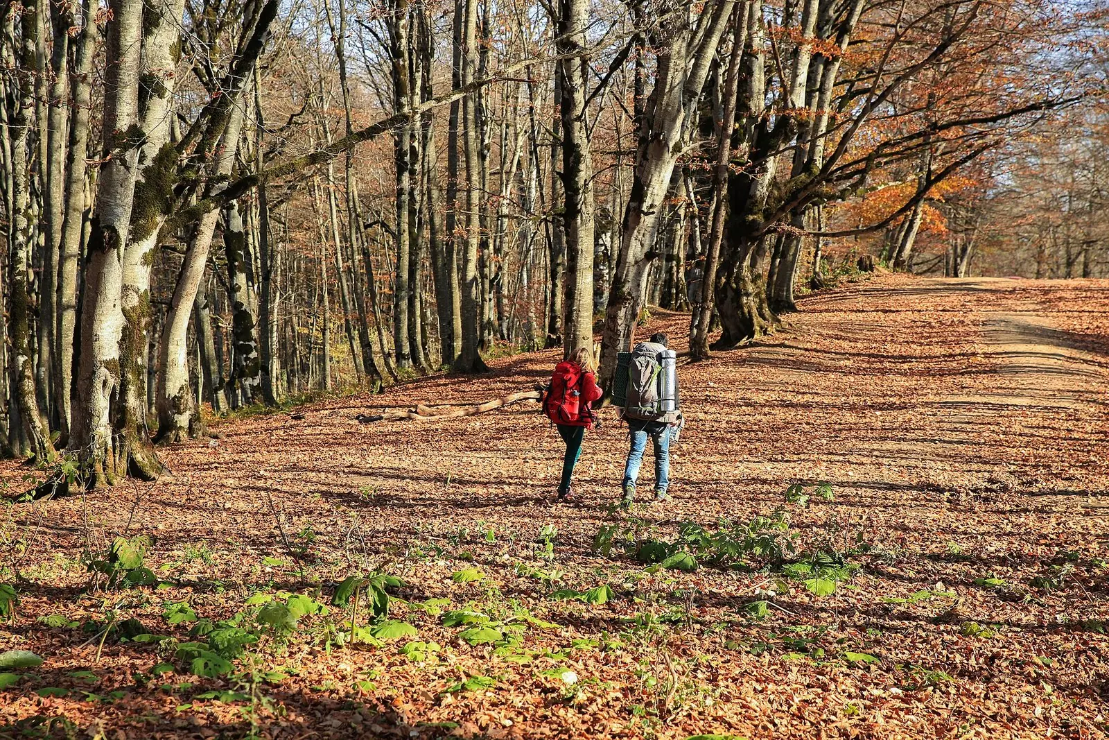
A little further on, a turn at Tsitsamuri leads ~5 km east to Saguramo. Here stands the country house of the writer Ilia Chavchavadze, and beyond it the forest trails of Tbilisi National Park begin. Both suit a slow day close to the city better than a run to Kazbegi.
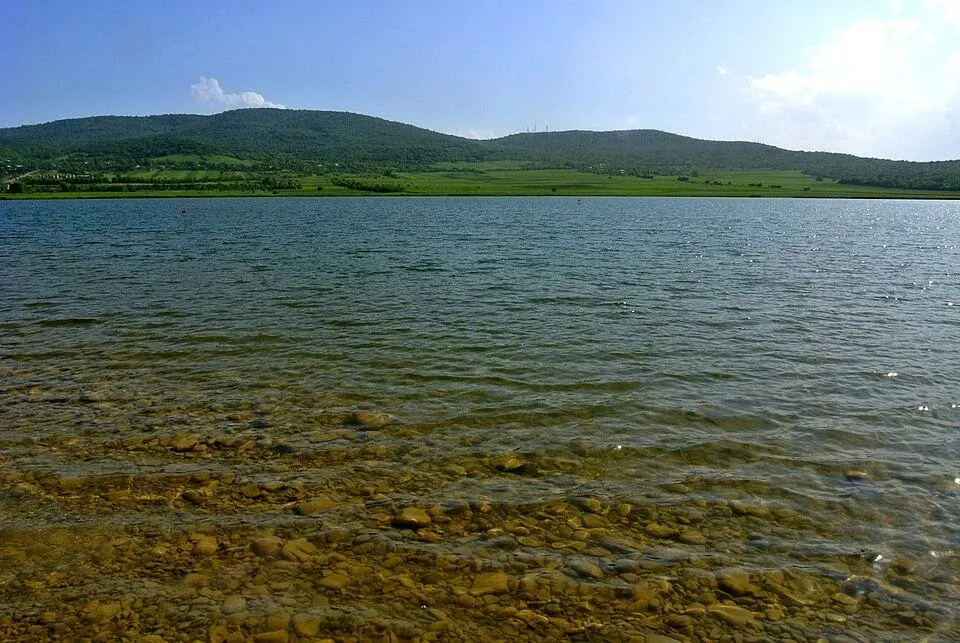
Bazaleti Lake and Dusheti (~45 km)
Near the town of Dusheti, a side road heads a few kilometres west to Bazaleti Lake. It is a small lake at 878 m where Tbilisi families swim and picnic in summer, and a local legend puts a golden cradle on its bed. The detour adds about an hour. Save it for a hot afternoon on the way home.
Zhinvali dam and the road to Khevsureti (~56 km)
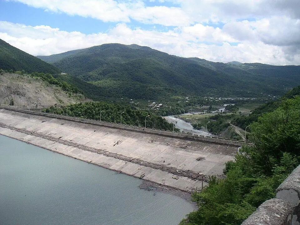
Next you pass the Zhinvali dam, a 102 m wall of earth and rock finished in the mid-1980s. The lake behind it supplies most of the capital's drinking water. A road branches east here up the Pshavi Aragvi to Barisakho and Roshka. In summer it continues over the Datvisjvari Pass to Shatili, but that route needs a 4x4 and two days at least.
Zhinvali Reservoir viewpoint (~60 km)
Soon the highway runs high above the water, and a row of stalls and cafes marks the main lay-by. From here you get the classic picture: Ananuri's towers on the far shore and blue-green water filling the valley. On sunny days between May and September the colour is at its brightest.
Ananuri Fortress (~65 km)
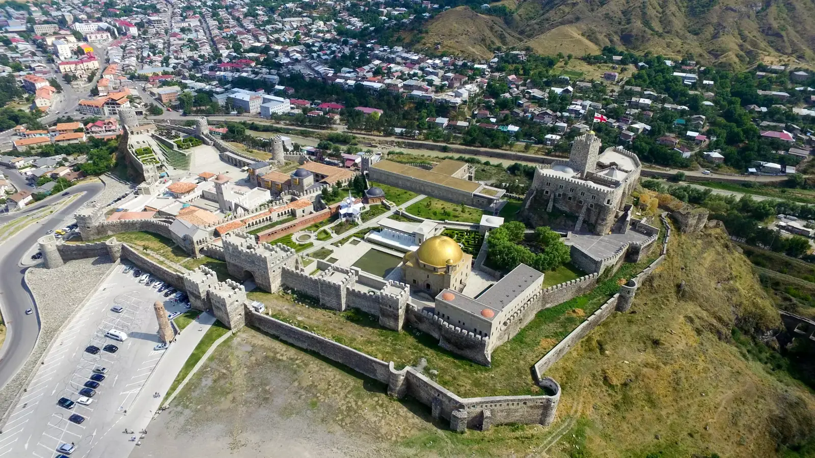
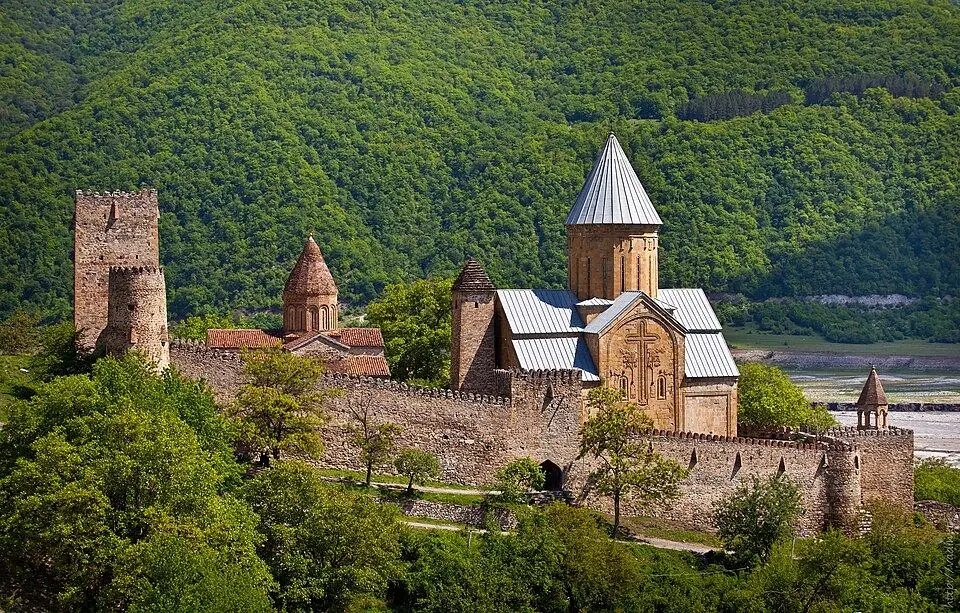
Ananuri was the seat of the Aragvi dukes, who held this valley from the 13th century. Inside its walls stand two churches and a tall square tower. The bigger of the two dates from 1689 and is dedicated to the Mother of God. Look for the carved cross wrapped in vines on its south wall, and for the fragments of fresco inside.
A rival lord, Shanshe of Ksani, stormed and burned the castle in 1739. Legend says the name honours Ana from the village of Nuri, who died rather than betray a secret tunnel to the river. Climb the tower for the view, taking care on its dark, steep stairs. Plan 45 minutes to an hour, and come before 10:00 or after 15:00 to miss the busiest hours.
Ananuri to Gudauri: Pasanauri and the Mleta hairpins (km 65 to 121)
North of the lake, the valley closes in and the road follows the White Aragvi between wooded slopes. This is Mtiuleti, and its main village is Pasanauri.
Pasanauri (~87 km)
Pasanauri sits at 1,050 m, about 90 minutes from Tbilisi. Beside the village the White and Black Aragvi join, and for a short stretch the two shades of water run side by side. Georgians link the village with khinkali. Its roadside restaurants cook the plain highland kind called mtiuluri: hand-chopped meat seasoned with onion and pepper, without the coriander of the city style.
It makes the classic lunch stop, going up or coming back. In winter, ask about the pass here before you start the climb.
Kvesheti and Mleta (~110 km)
Beyond Pasanauri the valley narrows again. Around Kvesheti you will notice the building sites of the new Kvesheti to Kobi road, which will tunnel under the ridge. A few kilometres on, at the village of Mleta, the old road leaves the river and starts to climb.
From Mleta it zigzags upward through tight hairpins for ~10 km to Gudauri. Loaded trucks grind up this stretch in low gear, so stay patient and pass only where you can see far ahead. Each year on the Wednesday after Orthodox Pentecost, crowds of pilgrims walk from Mleta to the St George church on Mount Lomisi for Lomisoba. In 2027 the feast falls on 23 June.
Gudauri (~121 km)
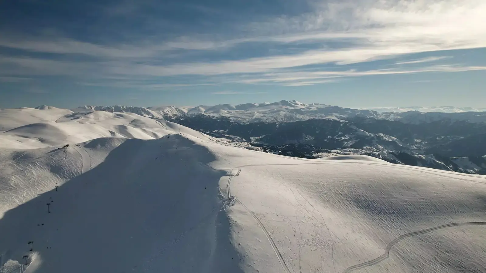
Gudauri, at ~2,200 m, is Georgia's biggest ski resort. From December to April skiers fill its hotels. In summer people come for paragliding, hiking and horse riding. Hotels and apartments line the road for a couple of kilometres. A short break is enough on a Kazbegi day, though a night here splits the drive well. Read our guide to skiing in Gudauri for winter plans.
Friendship Monument, Jvari Pass and the travertine springs (km 121 to 136)
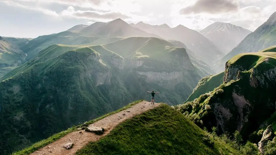
The next 15 km are the highest and wildest part of the drive.
Russia–Georgia Friendship Monument (~125 km)
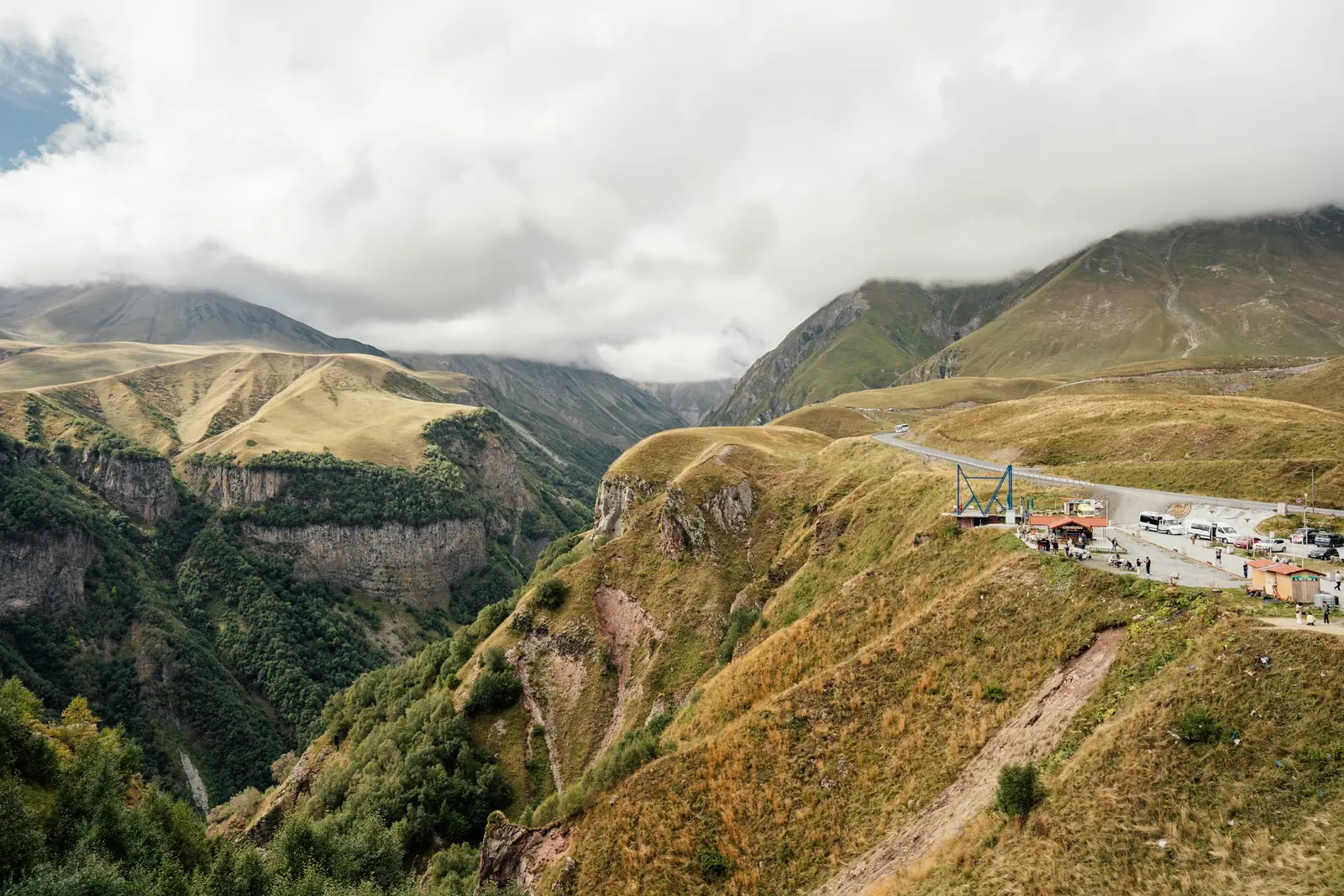
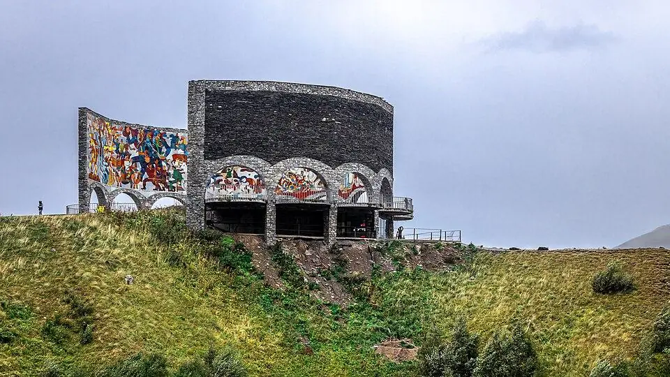
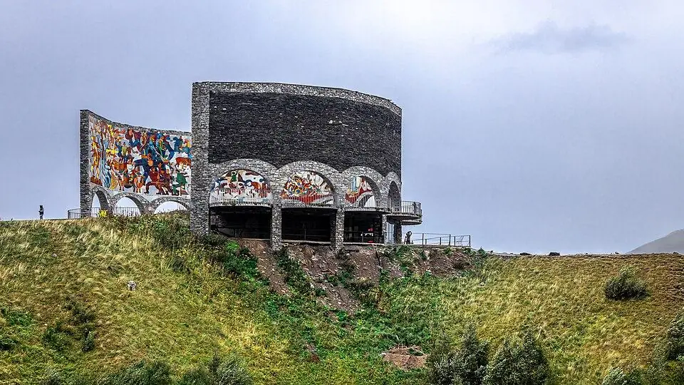
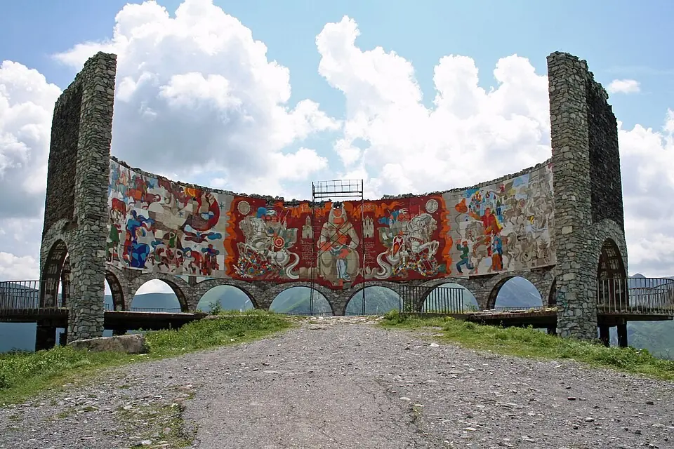
About 4 km past the resort, a curved concrete platform juts out over the Devil's Valley. Soviet authorities unveiled it in 1983, on the bicentenary of the Treaty of Georgievsk. A long tile mosaic of scenes from Georgian and Russian history and legend covers its inner wall. Most visitors now come for the view: a sheer drop, folded green slopes and, in summer, paragliders drifting below.
Allow 20 to 30 minutes. The edge falls away steeply, so keep children close. Wind makes the platform cold even in August.
Jvari Pass (~127 km)
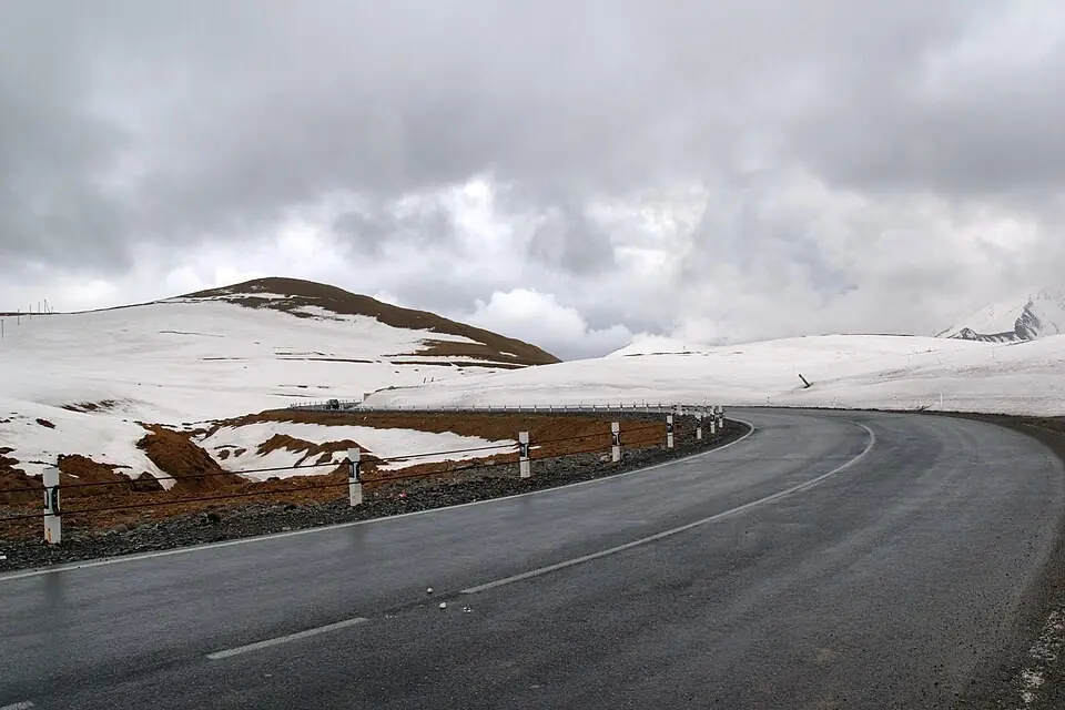
At ~2,379 m, the Jvari Pass, or Cross Pass, marks the top of the whole drive. It sits on the watershed between the Aragvi and the Tergi. A stone cross on a small mound gives it its name. Tradition credits King David the Builder with the first cross, and Yermolov raised the present one in the 1820s. Around it lie bare grassy slopes that stay under snow for about half the year.
Travertine springs (~130 km)
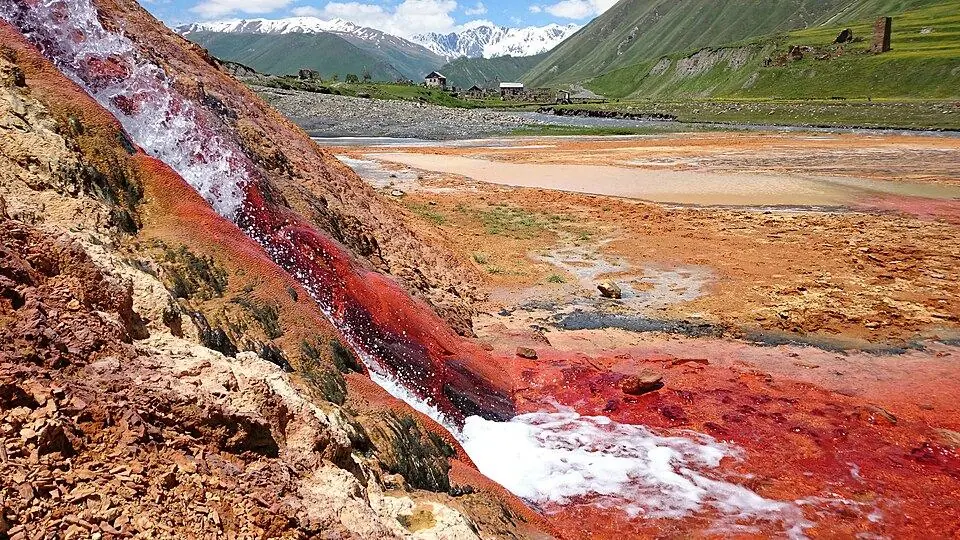
A few minutes north of the pass, mineral water trickles down the hillside and has stained it in orange, cream and rust terraces right beside the road. Park only where there is room and look from the edge. The crust breaks easily and the wet stone is slippery.
Avalanche galleries and Kobi (~136 km)
The descent passes through concrete avalanche galleries, so switch on your headlights. At the bottom lies Kobi, a tiny village at ~1,970 m on a high plateau. From here the Kobi gondola, ~7.5 km long and opened in 2019, rides back over the ridge to the Gudauri slopes.
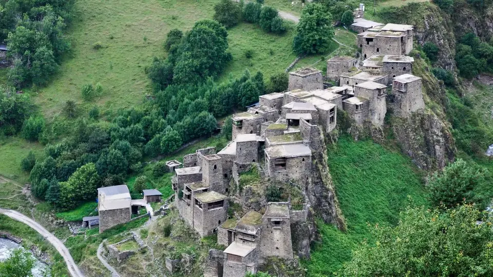
A dirt track also turns west from Kobi into the Truso Valley, with its fizzy mineral lake, coloured springs and empty tower villages. The valley needs a 4x4 or a half-day walk, so treat it as a separate outing from Stepantsminda.
Kobi to Stepantsminda: Sioni, Sno and the Khevi villages (km 136 to 154)
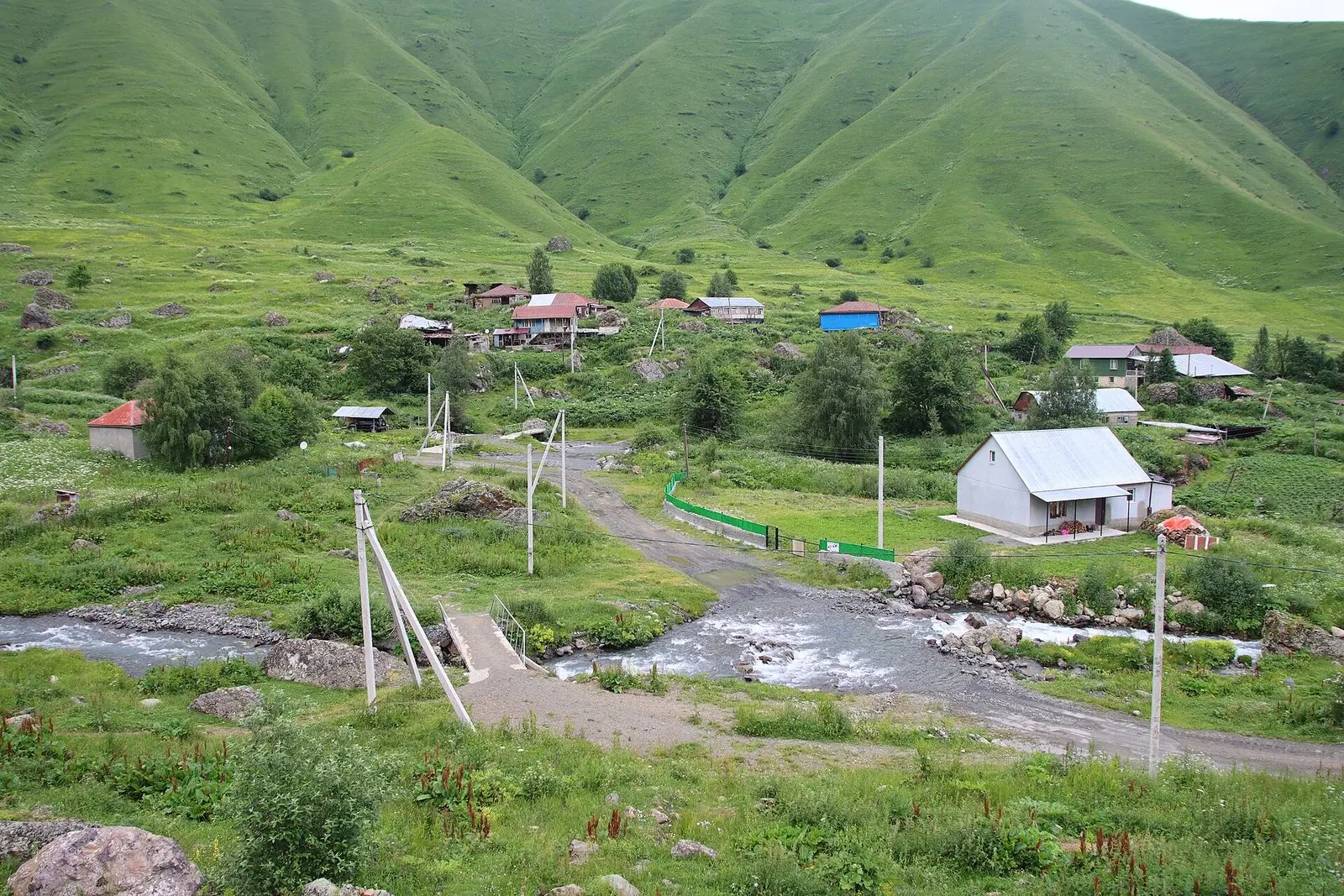
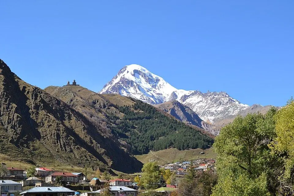
North of Kobi you are in Khevi, the gorge of the Tergi. The river runs beside the road, and on clear days the white cone of Mount Kazbek appears ahead and to your left.
Sioni (~143 km)
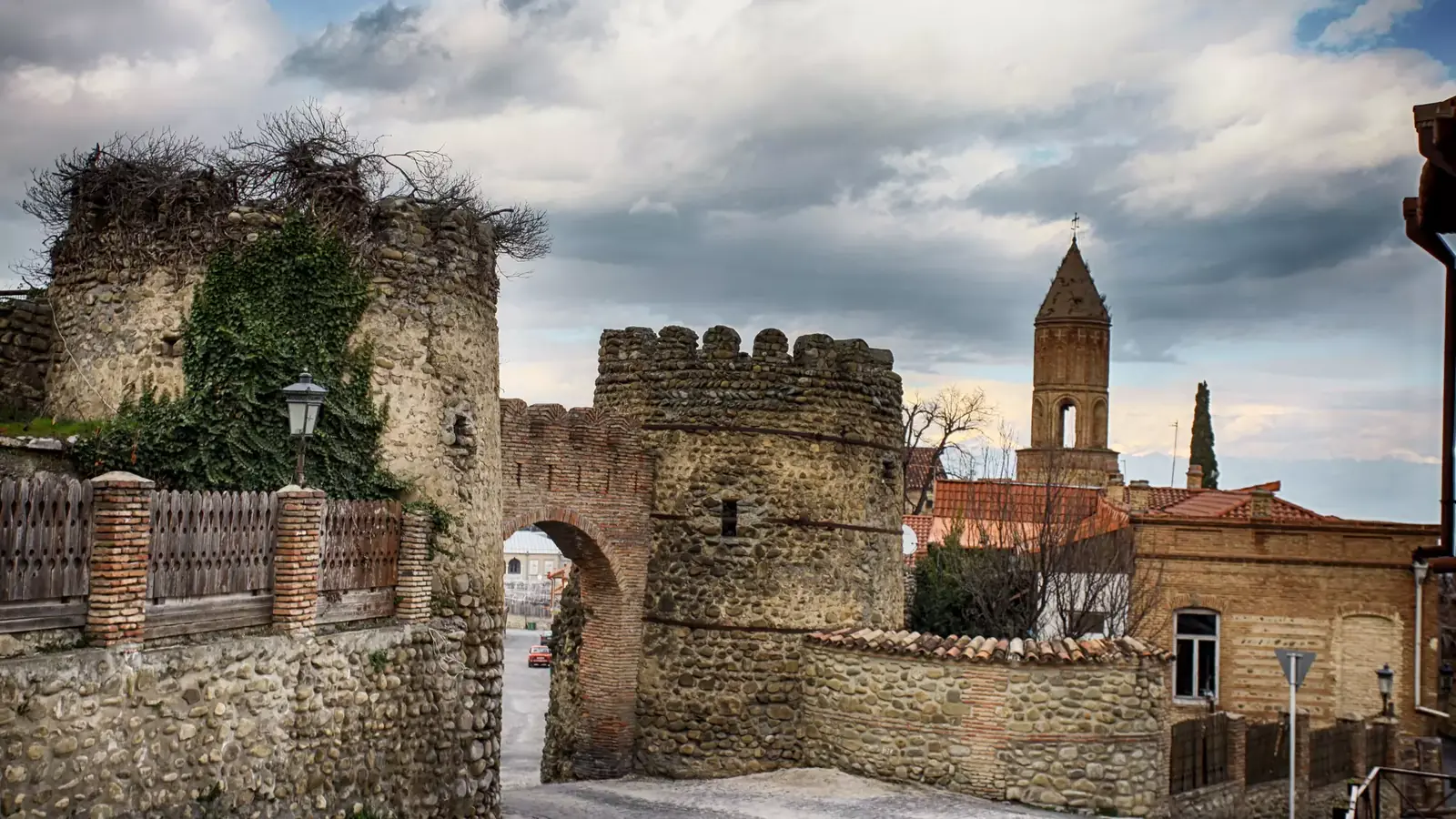
The village of Sioni keeps one of the oldest buildings in Khevi, a stone basilica of the 9th century, with the tower of a small castle beside it. It stands close to the road. Most tours drive straight past, so it is usually a calm 15-minute stop.
Sno and the road to Juta (~148 km)
At the next junction a side road turns east to Sno and on up its valley to Juta. In Sno, huge boulders carved into the heads of Georgian poets, writers and national heroes stand beside the road. They are the work of the local sculptor Merab Piranishvili, and an old watchtower rises behind the village.
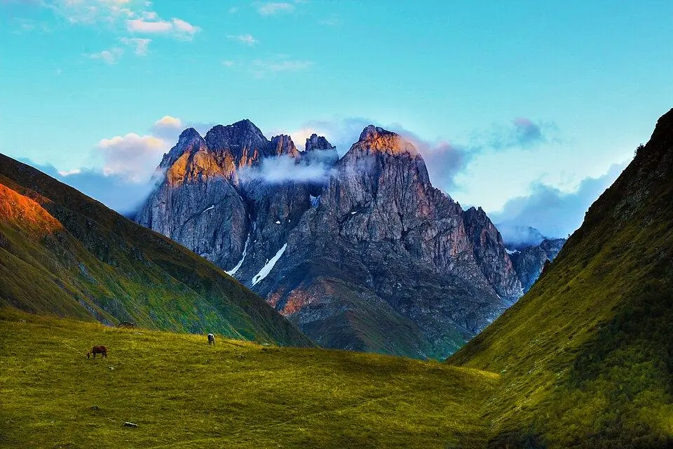
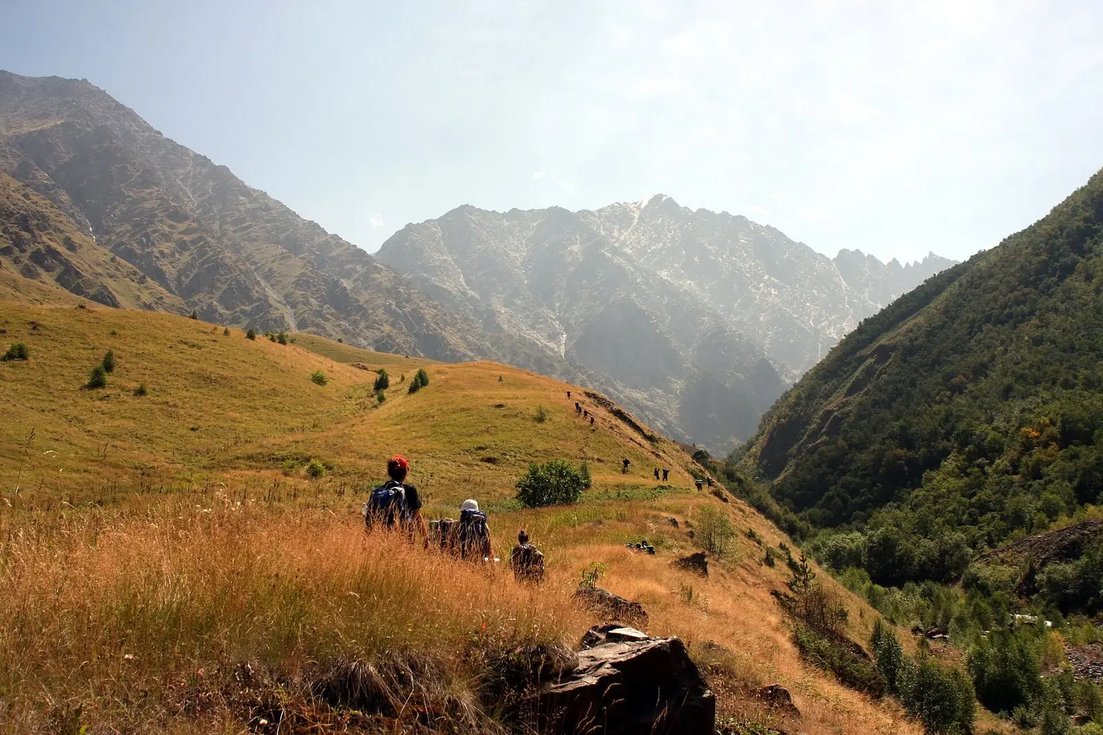
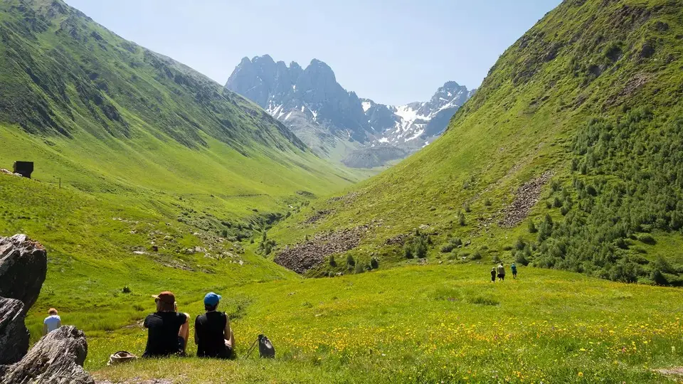
Juta lies ~15 km further up the valley, at ~2,200 m, where the jagged Chaukhi peaks close it off. It deserves half a day of its own. Landslides have damaged the upper road, so check the latest in Stepantsminda before you drive up.
Stepantsminda (~154 km)
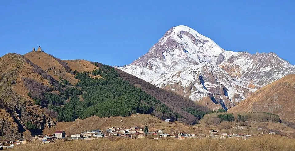
Stepantsminda, which most people still call Kazbegi, sits at 1,740 m beneath Mount Kazbek, which rises above 5,000 m. The town has cafes, cash machines and most of the area's guesthouses. On a day visit, park in the centre and switch to a local 4x4 for the church. Sleeping over? Read where to stay in Kazbegi for a comparison of the town and nearby villages.
Gergeti Trinity Church (2,170 m)
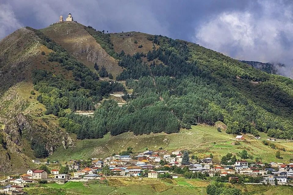
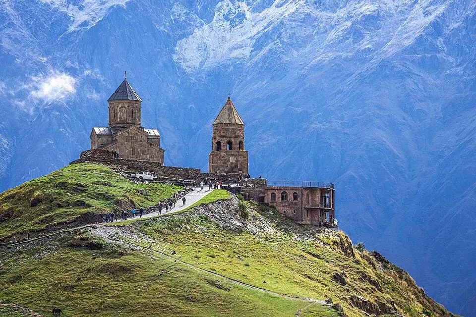
The 14th-century church stands on a grassy ridge ~430 m above the town, with Kazbek's glaciers behind it. A paved road takes cars up in 15 to 20 minutes. On foot, the old path takes about an hour and a half. Kazbek is clearest in the morning, and cloud often hides the summit by midday.
Beyond Stepantsminda: Gveleti, the Dariali Gorge and the border (km 154 to 165)
The final 11 km lead north into the Dariali Gorge. Its granite walls tower up to ~1,800 m above the Tergi, and the gorge, ~13 km long, straddles the border with Russia.
Gveleti Waterfall (~161 km)
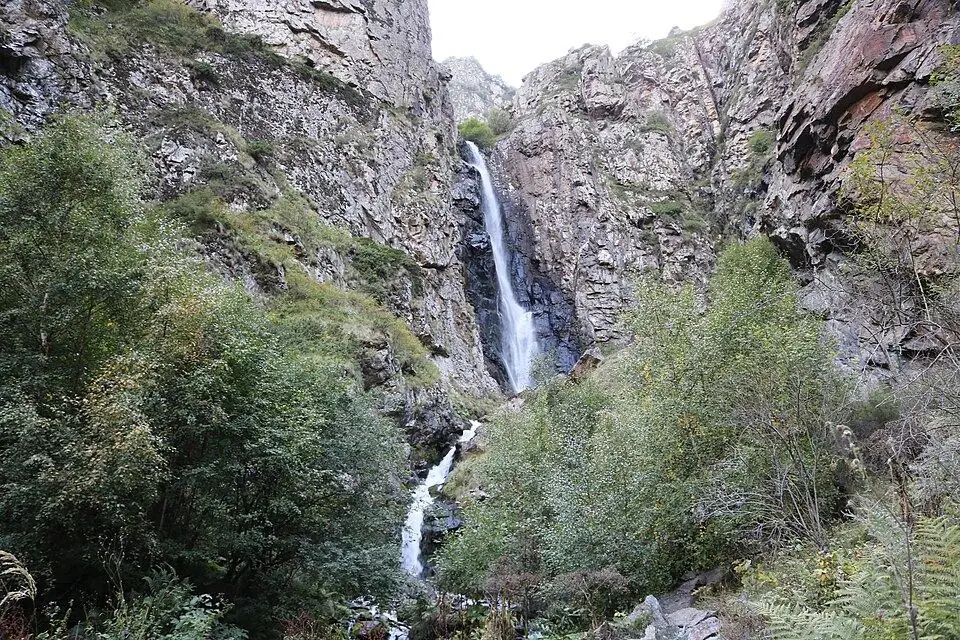
A bridge by the hamlet of Gveleti marks the start of a short, steep path to two waterfalls. The bigger fall plunges ~25 to 30 m in two steps. The walk takes 1 to 2 hours there and back and suits most families.
Dariali Monastery (~165 km)
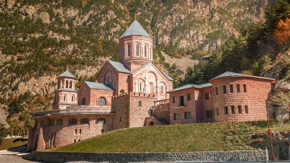
Just before the checkpoint, the rose-grey churches of Dariali Monastery stand beneath sheer cliffs. Building began in 2005 at the wish of the late Catholicos-Patriarch Ilia II, and the first church opened in 2011. Allow 30 minutes, then turn round.
Past the monastery is the Dariali checkpoint, Georgia's crossing to Upper Lars in Russia, which this guide does not cover. This is a border zone, so carry your passport and never photograph the checkpoint. Lines of trucks often wait along this stretch, so drive slowly.
The Georgian Military Road in winter: closures, tyres and stops
The road stays open all year because it is the main route to Russia. Its weak point is the ~14 km from Gudauri over the Jvari Pass to Kobi. The Roads Department shuts this section when snow or avalanche danger is high. Most closures last a few hours, some two or three days.
| Winter | Days with a full closure, Gudauri to Kobi | First full closure | Last full closure |
|---|---|---|---|
| 2021/22 | 17 | 19 Dec 2021 | 8 May 2022 |
| 2022/23 | 10 | 2 Feb 2023 | 8 Apr 2023 |
| 2023/24 | 12 | 19 Nov 2023 | 7 May 2024 |
| 2024/25 | 14 | 26 Nov 2024 | 14 Apr 2025 |
| 2025/26 | 13 | 9 Jan 2026 | 23 Apr 2026 |
In a typical winter, then, expect about two weeks of full closures, spread from late November to early May. Bans on trucks and trailers come far more often, but they do not stop cars. After very heavy snow the hairpins between Mleta and Gudauri can shut as well, as they did for a few hours on 24 December 2023.
On the Mleta to Kobi section, the law requires snowflake-marked tyres from the start of December to the start of March, and police can demand chains on the drive wheels. Drivers without them can be turned back and fined about 100 GEL (about $39) in 2026. Our Tbilisi to Kazbegi guide sets out the tyre rules in full. The road status tool links to the official closure list and records past closure dates.
Which stops work in winter
- Ananuri and the lake: open all year, and the walls look their best under fresh snow.
- Pasanauri: restaurants stay open, and locals know the state of the pass.
- Gudauri: in full ski season from late December, with heavy weekend traffic.
- Friendship Monument: open, though the platform can be icy and cloud often hides the view.
- Jvari Pass and the springs: mostly buried in snow, and no place to stop in a storm.
- Gergeti Trinity Church: reached by 4x4 through deep snow, while the footpath turns icy.
- Gveleti and Juta: the waterfall path freezes, and snow often blocks the Juta road.
Daylight is short as well: a December day in Stepantsminda ends around 17:30, so leave early and aim to cross the pass before dark.
Winter is still a fine time for the drive with the right driver. Our Ski Week in Gudauri adds a snowy day out to Gergeti, on dates you choose within the ski season.
How to plan a day on the Georgian Military Road
You can drive the road as a long day trip from Tbilisi or as the first leg of a stay in the mountains. Here is how the hours add up.
| Plan | Time | What you see |
|---|---|---|
| Short day | 9 to 10 h return | Reservoir viewpoint, Ananuri, Friendship Monument, Gergeti |
| Full day | 10 to 11 h return | Adds Pasanauri, the springs and Sno |
| Two days | One night in Stepantsminda | Every stop in this guide, plus Gveleti, Dariali and Juta or Truso |
| Three days or more | Two nights or more | Walks and hikes in Kazbegi National Park |
A day plan that beats the clouds
- 08:00 Leave Tbilisi
Skip Jvari this time and take just one coffee stop at the reservoir viewpoint. - 10:45 Friendship Monument
Have a quick look, then cross the pass while traffic is still light. - 11:30 Gergeti Trinity Church
Ride up by 4x4 in the hours when Kazbek is most often clear. - 13:30 Lunch in Stepantsminda
Then head south, stopping at Sno and the travertine springs. - 15:30 Pasanauri
Tea, or a late plate of khinkali by the river. - 16:15 Ananuri
By now the morning crowds have left the fortress. - 17:45 Back in Tbilisi
Allow longer on summer weekends, when traffic into the city is heavy.
Our private Kazbegi Day Trip normally makes its stops on the way up, but your guide can switch to this order. It runs on any date, for groups of any size and children of every age, with a guide in your language.
Temperatures along the road
The climb changes the weather fast, so pack for two climates. These are average daytime highs.
| Place | Altitude | Average July high | Average January high |
|---|---|---|---|
| Tbilisi | ~430 m | ~32°C | ~7°C |
| Ananuri | ~800 m | ~28°C | ~4°C |
| Pasanauri | 1,050 m | ~27°C | ~3°C |
| Gudauri | ~2,200 m | ~19°C | ~-4°C |
| Stepantsminda | 1,740 m | ~22°C | ~0°C |
Practical tips for the road
- Carry lari in cash for roadside stalls, toilets and the 4x4 up to Gergeti.
- Fill the tank before the climb at Mleta, and keep it above half in winter.
- Stop only in lay-bys. Trucks use the road day and night, and the hairpins are narrow.
- Cattle and sheep wander onto the asphalt around Gudauri and Kobi in summer, so slow down on blind bends.
- North of Stepantsminda you are in the border zone, so keep your passport with you.
- Every visitor to Georgia now needs a travel insurance policy worth at least 30,000 GEL. The requirement started on 1 January 2026. If you plan to ski, check that yours covers winter sports.
Want more than one day under Kazbek? Our Tbilisi, Mountains and Wine tour spends a night in Stepantsminda and walks into the Juta Valley. Our Kazbegi Hiking Week stays five nights in one hotel, with a new valley each day.
Georgian Military Road: frequently asked questions
How long is the Georgian Military Road?
The whole route from Tbilisi to Vladikavkaz in Russia is ~212 km. The Georgian section ends after ~165 km at the Dariali checkpoint. Stepantsminda, where most trips end, is ~154 km from Tbilisi.
How much time do you need for the Georgian Military Highway?
About 3 hours without stops in good weather. With the main stops, plan 6 to 8 hours one way. A return day trip from Tbilisi usually takes 10 to 11 hours.
What are the best Georgian Military Road stops?
Ananuri Fortress, the Zhinvali Reservoir viewpoint, Pasanauri for lunch, the Friendship Monument, the travertine springs below the Jvari Pass, Sno and Gergeti Trinity Church. With more time, add Gveleti Waterfall and Dariali Monastery north of Stepantsminda.
Does the Georgian Military Road close in winter?
Yes. It never closes for the season, but the high section between Gudauri and Kobi shuts whenever deep snow piles up or avalanches threaten. In the five winters up to 2025/26, that happened on 10 to 17 days a year.
Is the Georgian Military Road dangerous?
It is a paved two-lane road, and in summer thousands of cars use it safely every day. The risks are heavy trucks, tight hairpins below Gudauri, animals on the road, and snow and ice from November to April. In winter a local driver with winter tyres is the safest choice.
Why is it called the Georgian Military Road?
The Russian army built it between 1799 and 1863 to move troops and supplies between the North Caucasus and Tbilisi. The name stuck, even though today it mostly carries tourists and freight.
Can I see the Georgian Military Road on a day trip from Tbilisi?
Yes. A private day trip covers Ananuri, Gudauri, the Friendship Monument, the Jvari Pass and Gergeti, and brings you back the same evening. The day is long, so a night in Stepantsminda is more relaxed.
Where can I eat on the Georgian Military Road?
Pasanauri is the traditional lunch stop and is known for khinkali. Gudauri has hotel restaurants and cafes, and Stepantsminda has the widest choice. Stalls at Ananuri and the reservoir viewpoint sell churchkhela, honey and coffee.